Publié le 26 septembre 2026
Along Italy’s north-eastern Adriatic coast, the Lagoon of Grado forms a striking mosaic of shallow water, salt marshes, tidal flats and small islands. A new Copernicus Sentinel-2 image reveals the intricate network of tidal channels that shapes this protected wetland.
Covering around 90 square kilometres, the lagoon lies in the Friuli Venezia Giulia region, about 30 kilometres west of Trieste. A chain of sandy barrier islands separates it from the open Adriatic Sea, while channels carry water and sediment back and forth with the tides.
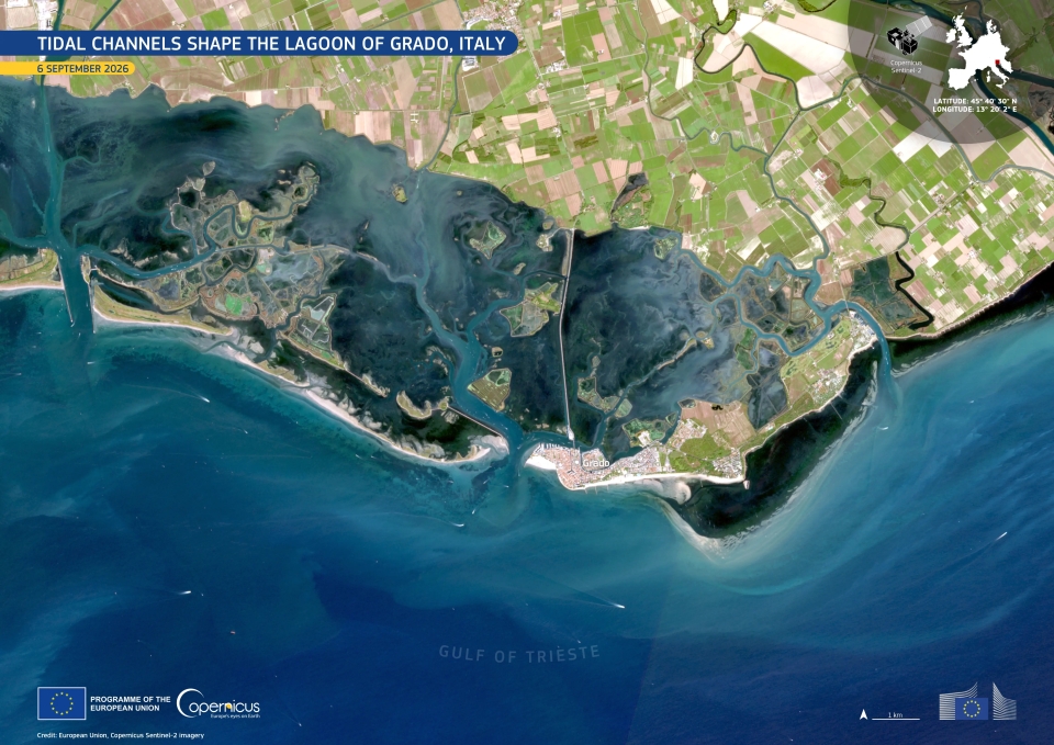
A network of meandering tidal channels cuts through the shallow waters and wetlands of the Lagoon of Grado in north-eastern Italy. Variations from turquoise to darker blue reveal changes in water depth and suspended sediment. The image was acquired by Copernicus Sentinel-2 on 6 September 2026.
Image: European Union, Copernicus Sentinel-2 imagery
Wetlands such as the Lagoon of Grado are constantly changing under the influence of tides, sediment transport, vegetation and human activity. Repeated observations from Sentinel-2 make it possible to follow these changes over time and monitor the condition of coastal ecosystems and shorelines.
With its frequent revisit time and multispectral imaging capability, Sentinel-2 is particularly well suited to observing complex coastal environments where land and water meet.
Based on: EU Space, Tidal channels shape the Lagoon of Grado, Italy, 26 September 2026.