Publié le 23 novembre 2021
According to the World Bank, more than a third of the world’s poor live in areas affected by multiple types of natural hazards. Aside from facing an increased frequency and intensity of hazards, developing countries sometimes have substantial data gaps which undermine decision-makers and development practitioners from making appropriate investments for risk reduction and mitigation.
By allowing objective, timely and precise observations continuously covering large spatial areas anywhere on the globe, Earth observation is an advantageous tool which can support the different phases of disaster management such as risk reduction, alert and response. “Earth observation information helps us to understand the level of exposure to risk we have in a region, as well as assess what happens after a disaster,” stated Anna Wellenstein, World Bank Regional Director for Sustainable Development in Latin America and the Caribbean.
Earth observation can predict and anticipate certain risks such as floods or storms notably through the use of high frequency meteorological satellites and high-resolution low Earth orbit satellites such as the Sentinel missions of the Copernicus programme. Moreover, it helps to better understand slow-onset events like droughts, since it allows monitoring changes over certain periods of time and identify trends.
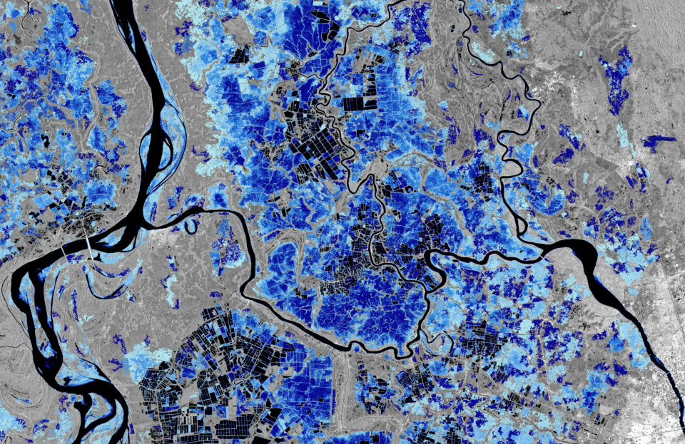
Copernicus Sentinel-1 flood monitoring
It can also assist the evaluation of potential impacts in the event of a natural disaster and assess the vulnerability of a population to multiple risks. It also provides emergency responders and information on damaged areas right after a disaster strikes, through mechanisms such as the International Charter Space and Major Disasters and the Copernicus Emergency Management Service (EMS). Earth observation can also support reconstruction and response efforts to disasters through rapid damage assessments, or by monitoring the progress of reconstruction efforts.