Publié le 24 octobre 2018
As part of a scientific collaboration with the Mexican Space Agency and other Mexican scientific public entities, ESA has combined images from the Copernicus Sentinel-2 mission to produce a detailed view of the different types of vegetation growing across the entire country.
The high-resolution land-cover map combines images captured between 2016 and 2018.
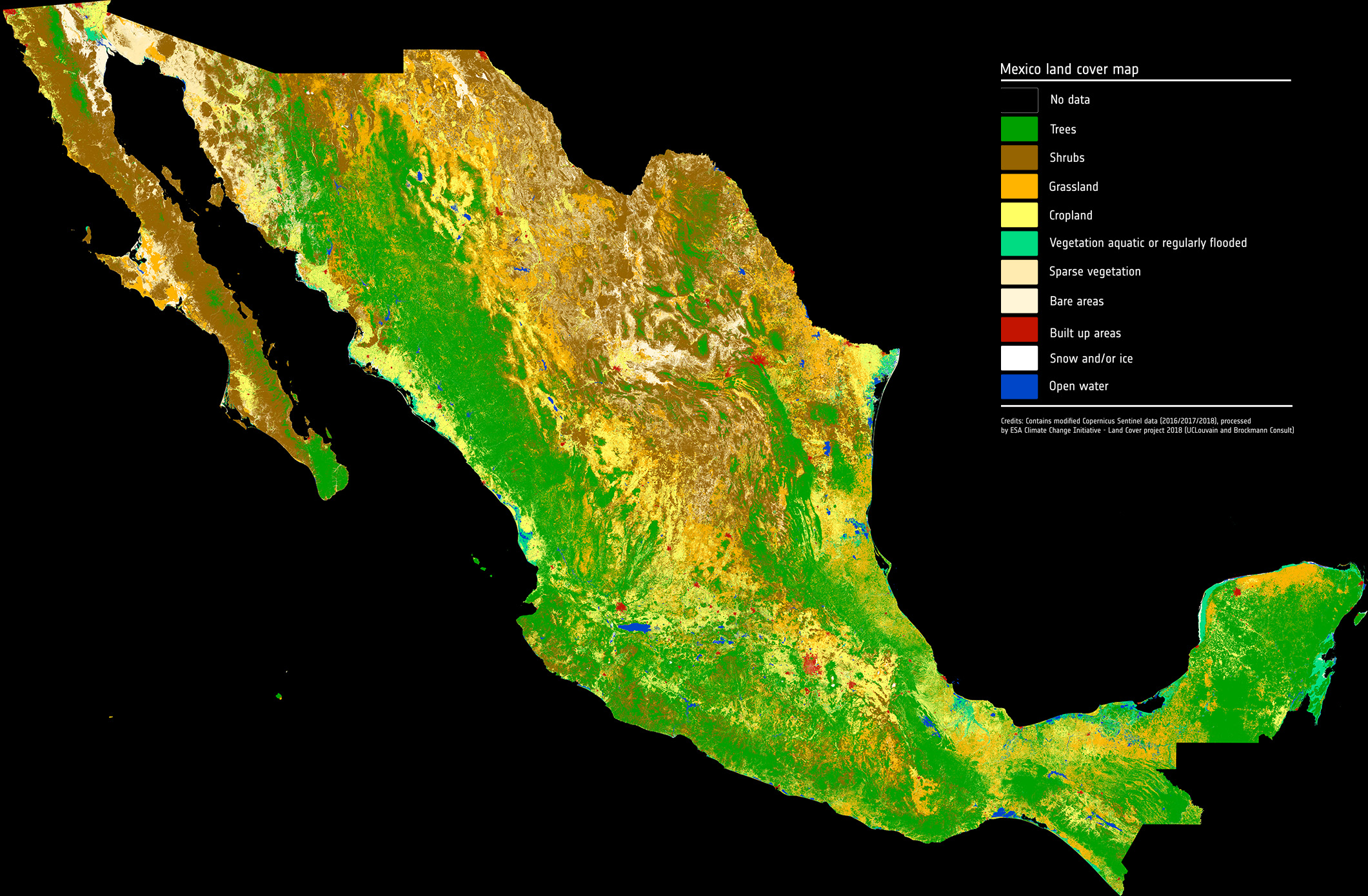
Sentinel-2 is a two-satellite constellation built for the EU’s Copernicus environmental monitoring programme. Each identical satellite carries a multispectral imager that can distinguish different types of vegetation and crops. It can also be used to determine numerous plant indices such as the amount of chlorophyll and water in leaves to monitor changes in plant health and growth.