Satellite characteristics
Launch Date - End 1056492000 - 1177192800
État Decommissioned
Orbit type Circular sun-synchronous orbit
Altitude 470
Orbit inclination 97.25
Equatorial crossing time 10:30:00
Orbit period 92.5
Satellite family: OrbView
The objective of this commercial satellite series is to acquire affordable high-quality imagery of the Earth for a variety of customers that include local governments, telecommunication companies, architects, civil engineers, real estate managers, farmers and environmental monitoring agencies.Sensor characteristics
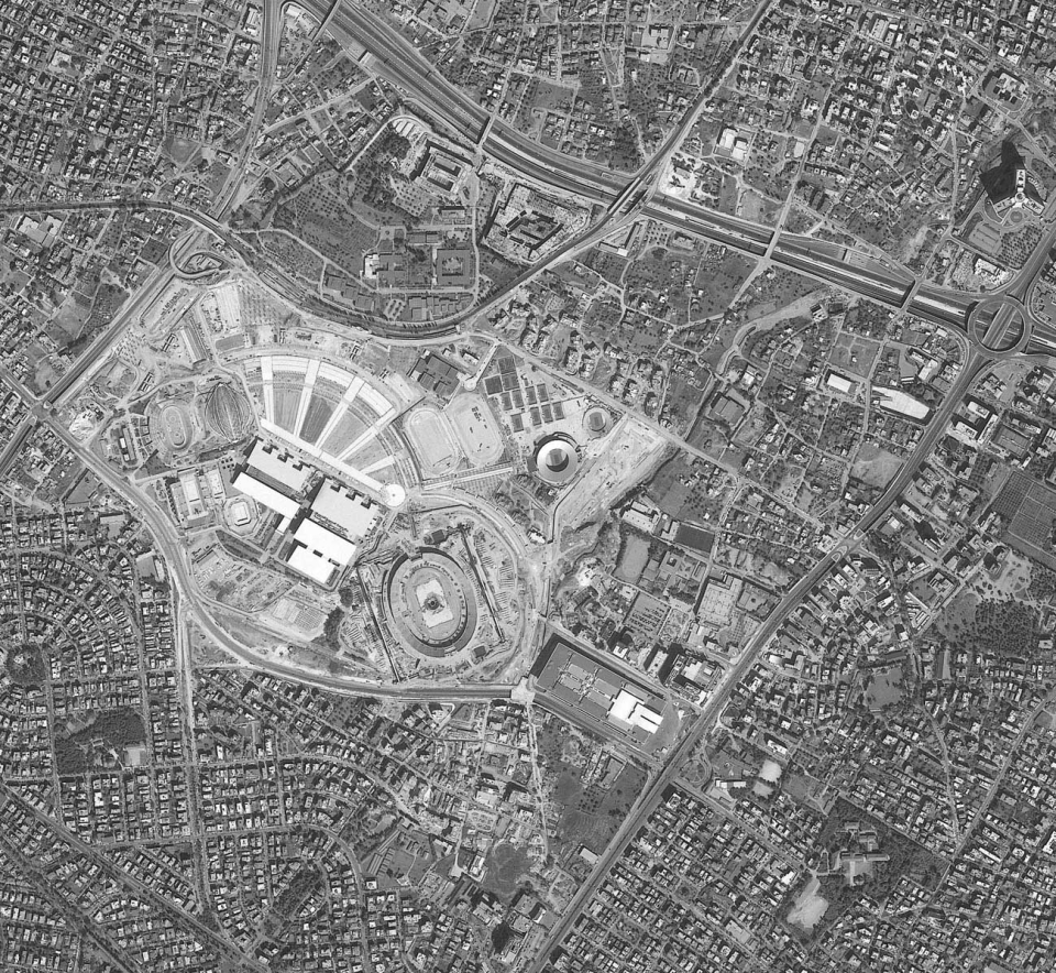
| Sensor name | OHIRIS (OrbView High Resolution Imaging System) |
|---|---|
| Sensor short description | |
| Sensor type | Imaging radiometer (Vis/IR) |
| Resolution class | Very High (1 - 5 m) |
| Spatial resolution | 1<br>4 |
| Swath width (at nadir) | 8 km |
| Revisit frequency | 3 jours |
| Max look angle | 50 ° |