Context and objectives
![]()
![]()
As human exposure and the associated health effects in hot spot areas are particularly affected by pollutants that have a strong local character and that exhibit strong concentration gradients at relatively small scales, such as nitrogen dioxide (NO2), there is a strong need for high-resolution operational NO2 exposure models. The currently available RIO-IFDM modelling tool performs moderately with regard to high-resolution spatial patterns. However, it can still be improved and needs to be validated extensively. The validation of the model with the spatial urban patterns of NO2 concentrations derived from APEX measurements is unique as before, models were only compared to point measurements.
The objectives of the BUMBA project were:
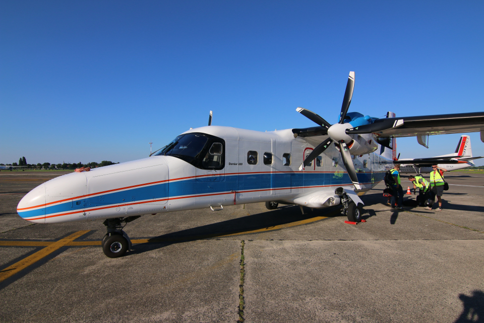
- To further develop and optimize a high-resolution APEX-based NO2 column mapping system;
- The conversion of these values to high-resolution surface layer NO2 concentrations;
- The use of these NO2 maps to validate and improve the high-resolution RIO-IFDM modelling system;
- The development of a near-real time high-resolution operational NO2 model and high resolution exposure calculations at IRCEL.
- The development of a validated operational NO2 mapping product within the APEX processing chain available for future APEX users.
Project outcome
Results
High resolution hourly maps of exposure to NO2 in the Belgian regions, produced in near-realtime by an improved and validated RIO-IFDM model chain installed at IRCEL-CELINE and made available through its website. The hourly model results are used to calculate daily, monthly and annual means and exceedance metrics if appropriate. The aggregated results can then be used for assessment of European standards, annual reporting on Belgian air quality, or as input for epidemiological studies.
The maps allow, in accordance with EU directive 2008/50/EC, to provide the Belgian population, policy makers and health and environmental organisations with optimized exposure estimates to air pollutants at a resolution of app. 100 x 100 m², providing a more realistic view of exposure, especially in major cities and in the vicinity of major roads, where steep concentration gradients of local pollutants are commonly found.
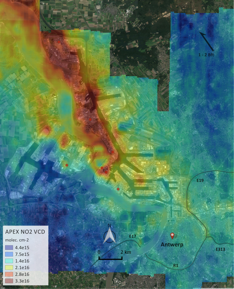
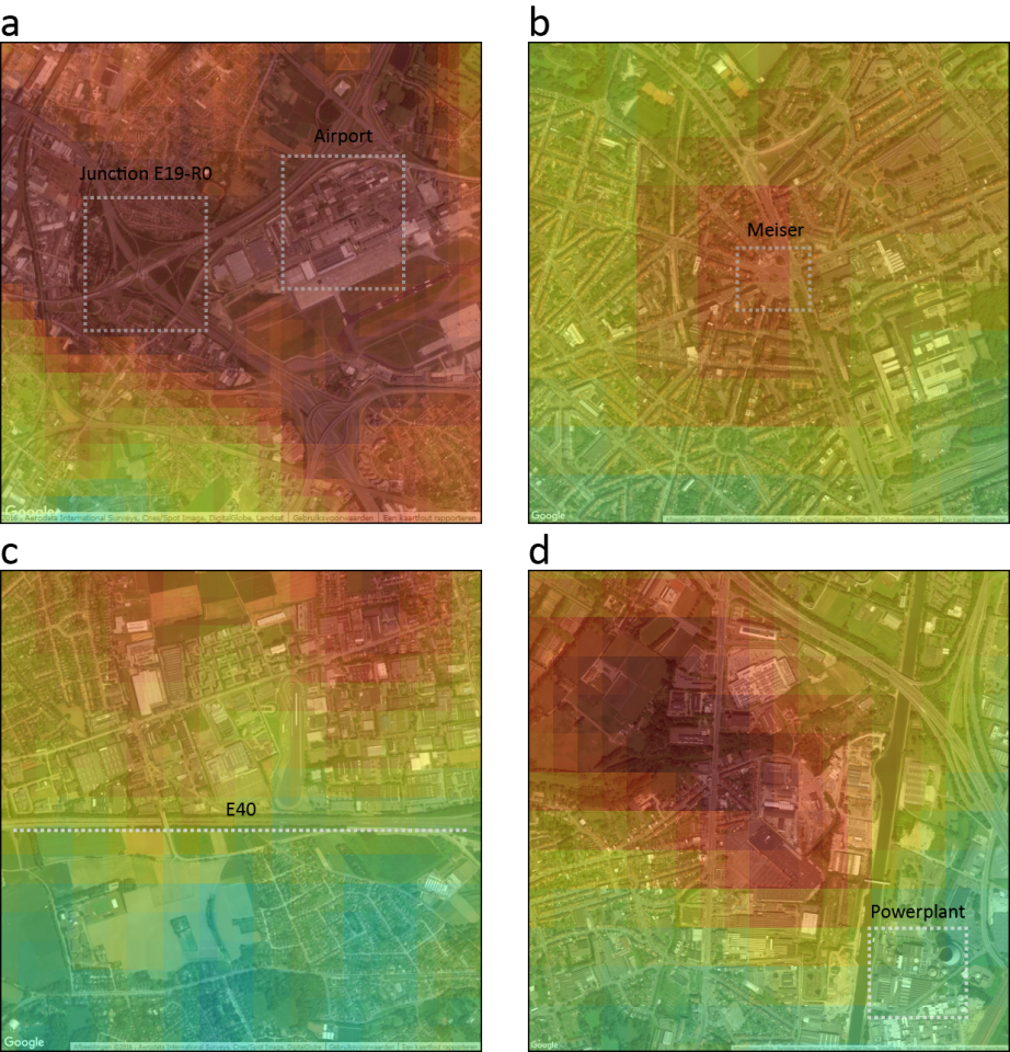
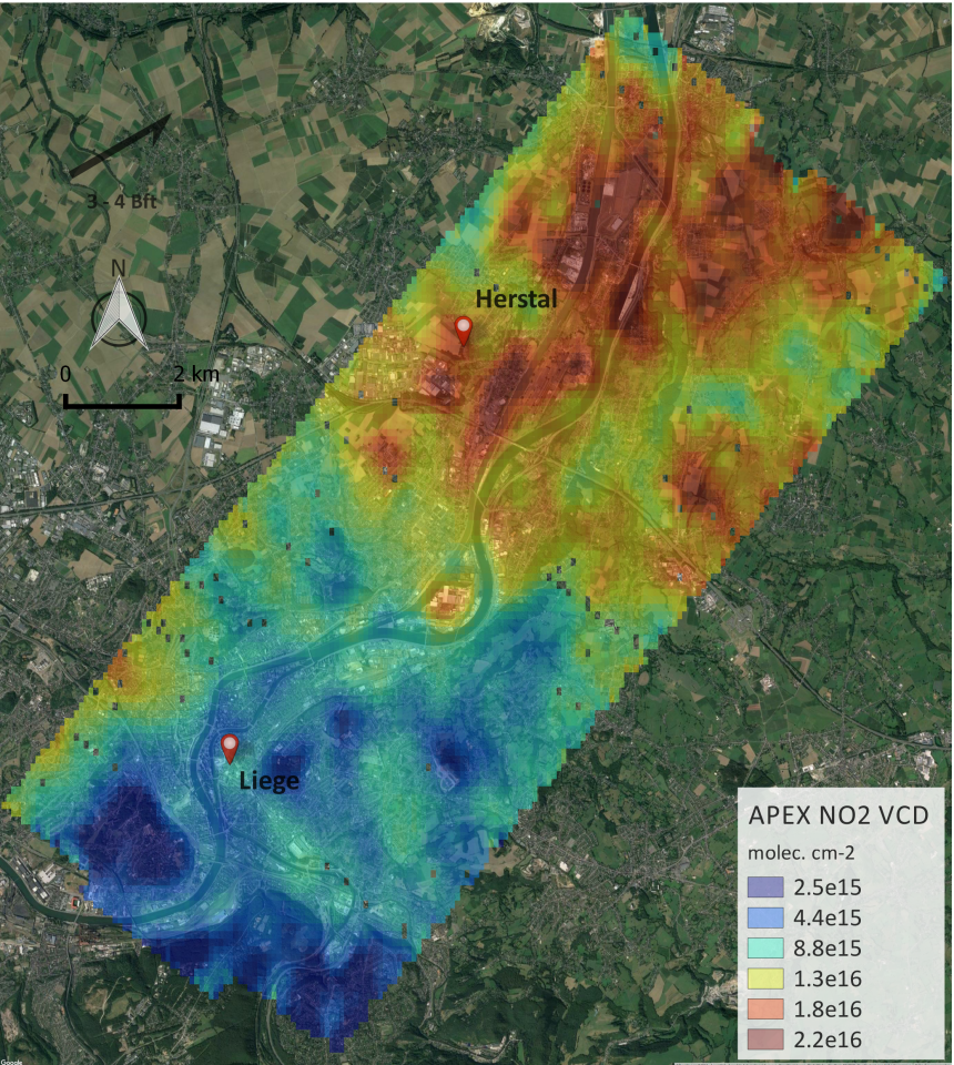
Next to the operational model chain, instantaneous NO2 exposure maps for Antwerp, Brussels and Liege, were derived from the APEX measurement campaign. These maps provide an independent view on air quality and exposure over these three cities.
Products and services
A near-realtime modelling chain that produces hourly maps showing the exposure of the Belgian population to NO2. These maps are available at http://geo.irceline.be/www/no2_hmean_rioifdm_EN.html.
Potential users
Air quality experts, policy makers and scientific researchers, but also environmental organisations of citizens with an interest in health and environment.

| Project leader(s): | IRCEL - CELINE (Belgian Interregional Environment Agency) | |
| Belgian partner(s) | ||
| Location: |
Country:
Region:
|
|
| Related presentations: | ||
| Website: | https://uv-vis.aeronomie.be/airborne/bumba.php | |