Context and objectives
This project is in line with continuous efforts of MRAC and ECGS-NMNH to monitor and understand the geodynamical processes of the Virunga Volcanic Province (VVP) in the frame of a global risk management/evaluation of the area.
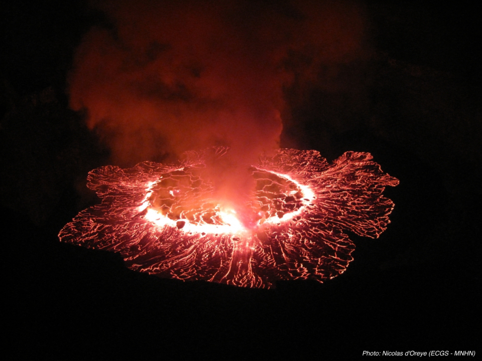
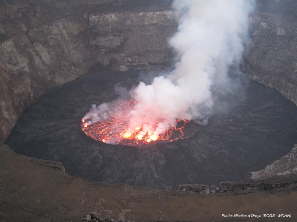
The Nyiragongo volcano and its semi-permanent lava lake threaten the city of Goma (~1 Mo inhabitants) distant of ~12km. The last eruption in Januray 2002 devastated approximately 10 % of the city including major infrastructues (roads, airport, public and private buildings). The Nyamulagira volcano is located 15 km NNW of Nyiragongo erupts in average every 2-4 years. Its lava flows repeatedly destroy large forested areas of the Virunga National Park.
In this context, high resolution SAR products are highly desirable and necessary to 1/ pursue the InSAR monitoring initiated with ENVISAT in 2006, and 2/ exploit the unvaluable DEM that will be produced in the TANDEM-X mission. Recently, DLR launched the TD-X SAR sensor that, with the already operational TerraSAR-X sensor, makes the Tandem-X mission. This Tandem mission offers unprecedented possibilities in terms of SAR Remote Sensing. Therefore, it will be now possible to generate a full DEM of the whole studied area. Moreover, since being wide band sensors, they offered the possibility to perform split-band interferometric measurements on the lava lake, which are axpected to allow lava lake levelling.
Project outcome
- Development and validation of an InSAR processing chain for bi-static radar data TanDEM-X for the production of high-resolution DEM;
- Demonstration of interest of accurate topography to map lava flows and volcanic cones at regional and local scales. For the first time, an accurate lava flow volume was provided for a Nyamulagira eruption;
- Classical InSAR has been applied to map ground deformations and allowed the detection of concentric deformation inside the Nyiragongo crater related to lava lake level variations.

| Project leader(s): | MRAC/KMMA - Natural hazards and cartography | |||
| Belgian partner(s) |
|
|||
| International partner(s) |
|
|||
| Location: |
Country:
Region:
|
|||
| Related publications: | ||||
| Website: | http://www.ecgs.lu/vi-x-project/ | |||