Published on 14 August 2020
The European Copernicus programme has become the world's leading supplier of satellite imagery. This ambitious and operational provides free and open access to impressive time series of satellite images supplemented by in situ data. No less than 12 terabytes of data are produced every day and the services offered by the programme are expected to be provided for decades to come. It is an opportunity to improve the daily life of all European citizens. Farmers, in particular, can benefit from access to this free data to improve the management of their plots.
Reduced environmental impact
Funded by the STEREO programme, the Belgian platform BELCAM (Belgian Collaborative Agriculture Monitoring) was built to make the wealth of satellite-derived information available, relevant and usable to all the Belgian farmers, thus helping them to help them to meet societal expectations. Applying correct doses of nitrogen fertilizers, at the right time and in the right place contributes to their full absorption by the plants and greatly minimizes their impact on the environment and their associated carbon footprint while improving farmers’ incomes.
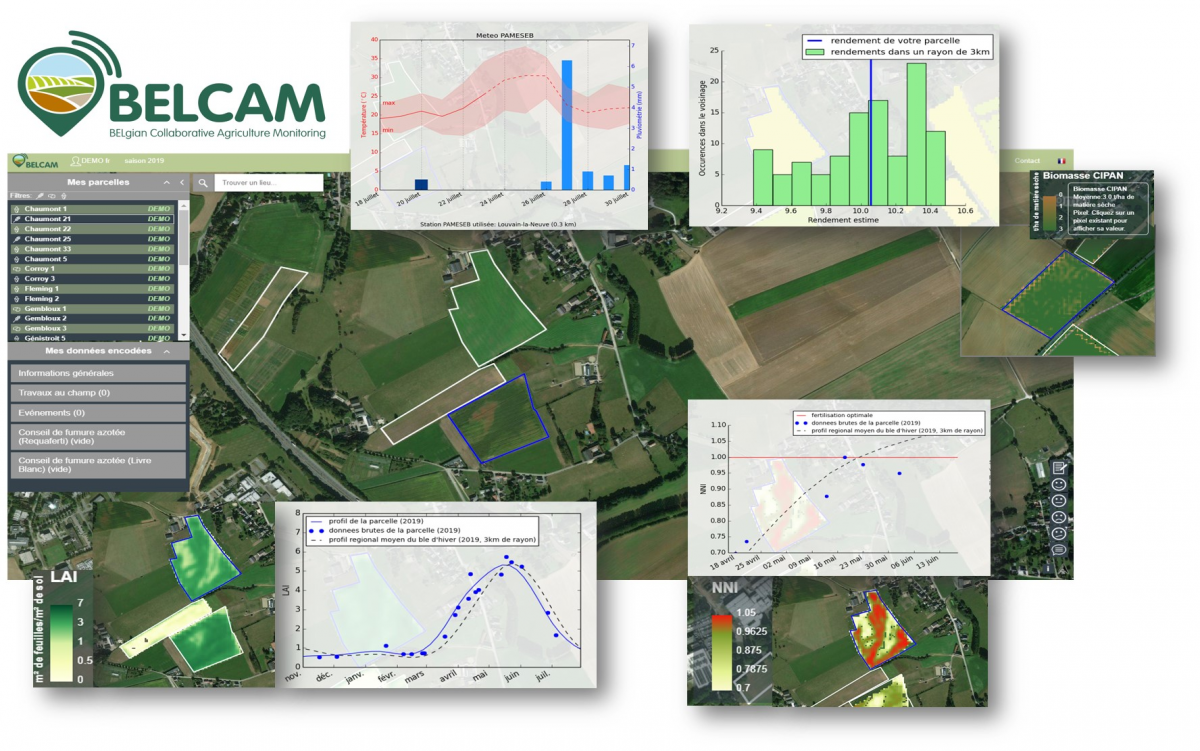
BELCAM platform: information available for a wheat field in July 2019, along with the yield and biomass of the ICNT (intermediate crops nitrate traps) for the 2018 season.
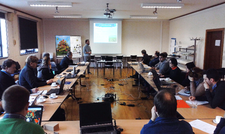
The project was so successful that the BELCAM platform was launched at the Libramont Agricultural Fair in 2019, as the result of a 4-year research project funded by the Belgian Science Policy (BELSPO) involving universities (UCLouvain, ULiège), research centers (CRA-W, VITO, INRA), technical centers and farmers. Continuous interactions with a dozen Technical Centres/Pilot Centres working as an extension service to support the farmers allowed identifying the priorities and fine tuning the Earth Observation (EO) methodological development and the resulting BELCAM products.
The platform relies on this satellite data to offer Belgian farmers innovative EO-derived products and services allowing them to improve the daily management of their plots and therefore the sustainability of agricultural practices.
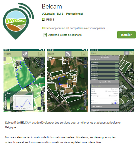
Plots on your smartphone
Available free of charge via a smartphone application or directly on a PC, BELCAM allows each farmer to identify his plots to view the most recent satellite images of his fields, the evolution of weather conditions and the 7-day forecast based on the nearest weather station. Providing information updated every 5 days, BELCAM allows Belgian producers to use images from EO satellites Sentinel-2A and 2B to monitor three different crops (wheat, maize, potato) more specifically but also the whole landscape.

The platform, being a key interface with farmers, provides various information at the pixel level, as illustrated for this wheat field in 2019: the LAI profile describing the growth of plants throughout the season, the estimated yield compared to the local average (3 km radius) and the NNI index. While the yield is just average, the field appears to be heavily over-fertilized (NNI> 1) except in one specific area. Defining two management zones (as shown by the NNI and LAI maps of June 17) could improve the environmental impact as well as the farmer's income.
Far beyond images and weather forecasts, each producer who has identified his plots on the platform has access to three types of information:
- First of all, the increase of the crop biomass which is closely linked to the evolution of the Leaf Area Index (LAI) is represented in the form of a growth curve. The curve reaches a maximum when the green vegetation of the field is at its maximum extent. This curve can also be compared to the average of the plots of the same crop within a 3 km radius.
- A second piece of interesting information for wheat cultivators is the performance of nitrogen fertilization using the Nitrogen Nutrition Index (NNI). This is the ratio between the nitrogen actually absorbed by the crop and the maximum amount of nitrogen that the crop could absorb to achieve maximum yield. An NNI greater than 1 indicates that the nitrogen applied won’t be absorbed by the crop and will not increase the yield. Thanks to Sentinels images, the NNI can be calculated for Belgian winter wheat plots.
- Yield estimation is the third type of information offered by BELCAM. It allows farmers to compare the estimated yield of a plot with the average of neighbouring plots of the same crop. Yield is estimated before harvest using a growth model that combines satellite imagery and local weather data.
For and with farmers
Beyond these innovations supported by state-of-the-art EO research, the originality of BELCAM lies in the collaborative nature of the platform which is today redesigning exchanges between farmers and scientists by entering the digital world of tomorrow.
Thanks to the interactions across the platform, it will continue to evolve from user feedback and take an interest in other cultures and emerging practices.
The challenge is to take advantage of these new observation technologies and provide the information to enable farmers to strengthen the sustainability of their practices.
More information
Belgian BELCAM platform (Belgian Collaborative Agriculture Monitoring)