News
A Belgian space scientist with a green mission
Published on 19 July 2024
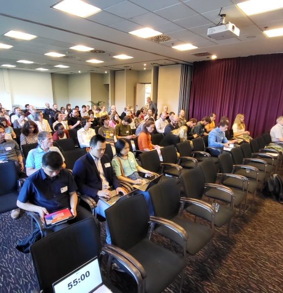
Celebrating the Success of Belgian Earth Observation Day 2024
Published on 23 May 2024
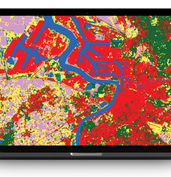
TERRASCOPE II Unveiled: Belgium Expands Its Free Satellite Imaging Services
Published on 18 April 2024
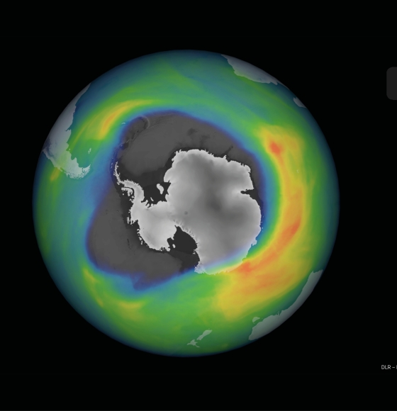
ALTIUS: the Belgian flagship mission to monitor the atmosphere
Published on 16 February 2024
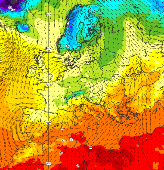
Forecasting beyond predictability: Immersion into the European Centre for Medium-Range Weather Forecasts
Published on 24 January 2024
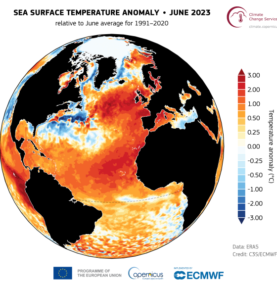
NORTH-HEAT: Marine heatwaves, or when swimming in 30-degree seas will soon be the norm
Published on 8 December 2023
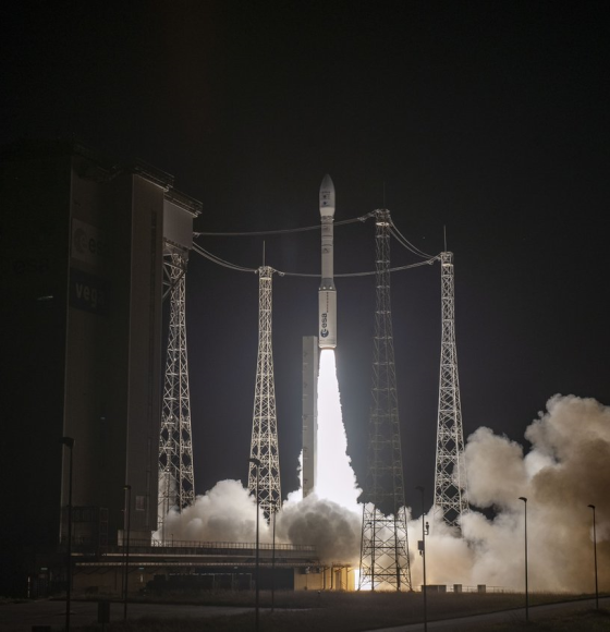
Belgian Nanosatellite PVCC Successfully Launched: A New Era in Earth Observation
Published on 31 October 2023
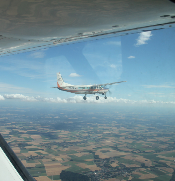
BELSAR-Science: Bridging the gap in agricultural remote sensing with bistatic radar
Published on 7 September 2023
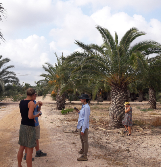
PALMWATCH: Remote sensing to the rescue of palm trees
Published on 27 June 2023
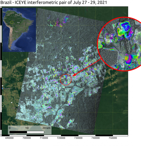
ECTIC: Environmental Change tracking using the ICEYE Constellation
Published on 12 May 2023