Published on 19 March 2021
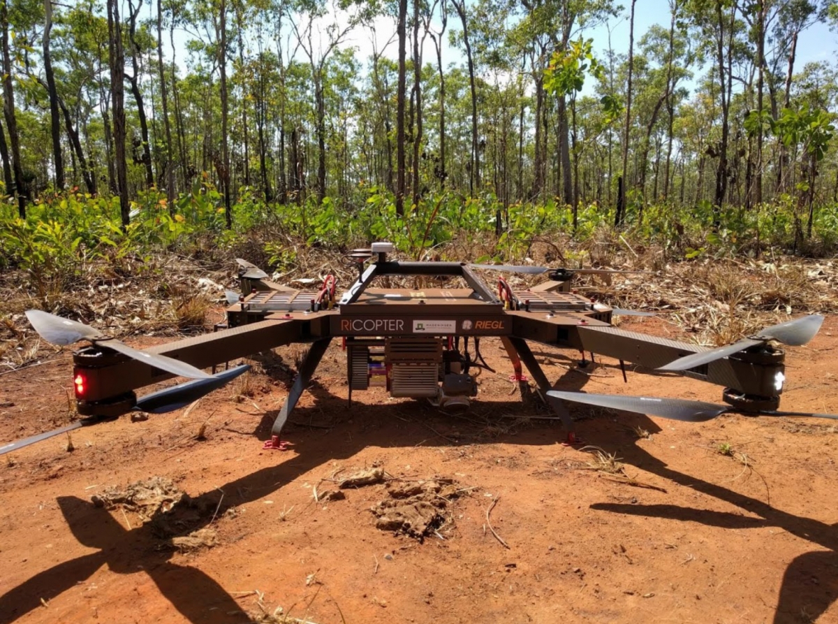
New research, funded by the STEREO programme (3D-TERRAIN & 3D-FOREST), has demonstrated the use of UAS LiDAR for characterising termite mounds in tropical savannas. In 2018 a team of researchers from Ghent University, Wageningen University, CSIRO and the Australian government collected UAS LiDAR data at the Litchfield National Park in Australia using a RIEGL RICOPTER, equipped with a VUX-1UAV scanner.
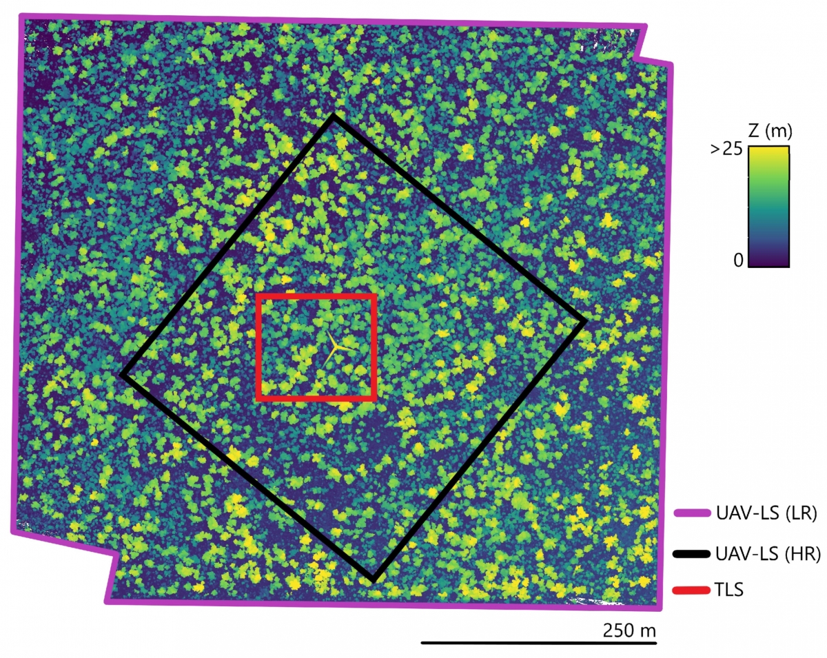
UAS lidar (low resolution) point cloud, indicating the boundaries of all data types. The colour code represents the height above terrain. The maximum tree height is approximatively25 m, and the open canopy allows a substantial understorey (D’hont et al., 2021).
Not only did they manage to model the forest in 3D, but the acquired lidar point cloud uncovered hundreds of termite mounds, spread out underneath the canopy. The termites that inhabit those mounds are true ecosystem engineers: they, for example, increase water infiltration due to their extensive network, and can create small fertility islands by concentrating nutrients close by the mound. On top of that, mounds are hypothesized to increase resilience to climate change, and are considered to play a meaningful role in savanna restoration.
This ongoing list of ecosystem services makes the detection and mapping of these mounds over large areas important: it could give us valuable information about the spatial distribution of these mounds, and unravel the underlying mechanisms by which they influence ecosystem functioning.
|
In September 2018, the research team conducted two flights over the LitchField Savanna SuperSite, which is part of Australian Terrestrial Ecosystem Research Network (TERN). Using different flight speeds, these flights resulted in two LiDAR point clouds with a different point density. An algorithm to semi-automatically detect termite mounds from this UAS LiDAR data was developed, and benchmarked against a more detailed dataset that was collected using terrestrial LiDAR.
They respectively detected 82 % and 72% of the mounds (higher than 50 cm) in the high and low resolution point cloud. In addition, they were able to estimate mound height and volume. This new work opens up the ability to monitor mound size: to see whether the mound is continuously growing, or if it is abandoned and eroding.
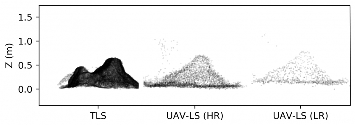 |
One termite mound, three different methods of acquisition (D’hont et al., 2021)
This is the first time termite mounds are detected over a relatively large areas with this level of detail, using remote sensing techniques. Currently, large area data sets are based on sparse aerial laser scanning (ALS) data or high resolution satellite data. Both lack the detailed 3D information that UAS LiDAR can provide, which is needed to reliably detect termite mounds in savannas with a dense understory, especially if they are small. This methodology opens up a range of possibilities for termite mound analysis, and demonstrates the possibilities of UAV-LS in savanna woodland, in which not only mere detection of termite mounds is possible, but also 3D information is available.
More information
Characterising Termite Mounds in a Tropical Savanna with UAV Laser Scanning (Remote Sensing Journal)