Gepubliceerd op 21 september 2026
Folded ridges, sweeping valleys and exposed rock layers make the Flinders Ranges one of South Australia’s most striking landscapes. A false-colour Copernicus Sentinel-2 image brings out geological structures that record hundreds of millions of years of Earth history.
Stretching across the arid interior of South Australia, the ranges include the protected Ikara-Flinders Ranges National Park. From space, their parallel ridges and curved folds reveal the forces that shaped this ancient terrain.
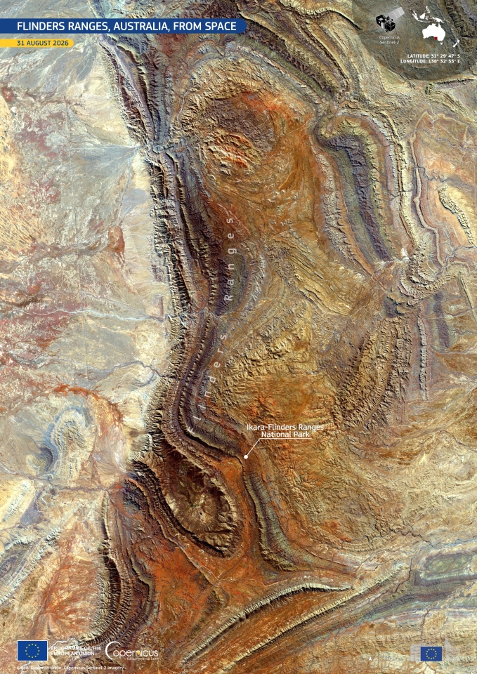
Parallel ridges and curved folds stand out across the Flinders Ranges in this false-colour Sentinel-2 image acquired on 31 August 2026. Variations in orange, brown, blue-grey and pale tones highlight differences between exposed rock, soil and sparse vegetation.
Image: European Union, Copernicus Sentinel-2 imagery
Sentinel-2’s multispectral observations make it possible to distinguish subtle differences in surface materials and vegetation across remote landscapes such as these. Repeated acquisitions also help track how land cover and vegetation conditions change over time.
The Flinders Ranges are a particularly striking example of how satellite imagery can reveal not only what a landscape looks like today, but also traces of the geological processes that shaped it over immense timescales.
Based on: EU Space, The Flinders Ranges reveal ancient geology in South Australia, 20 September 2026.