Gepubliceerd op 2 maart 2020
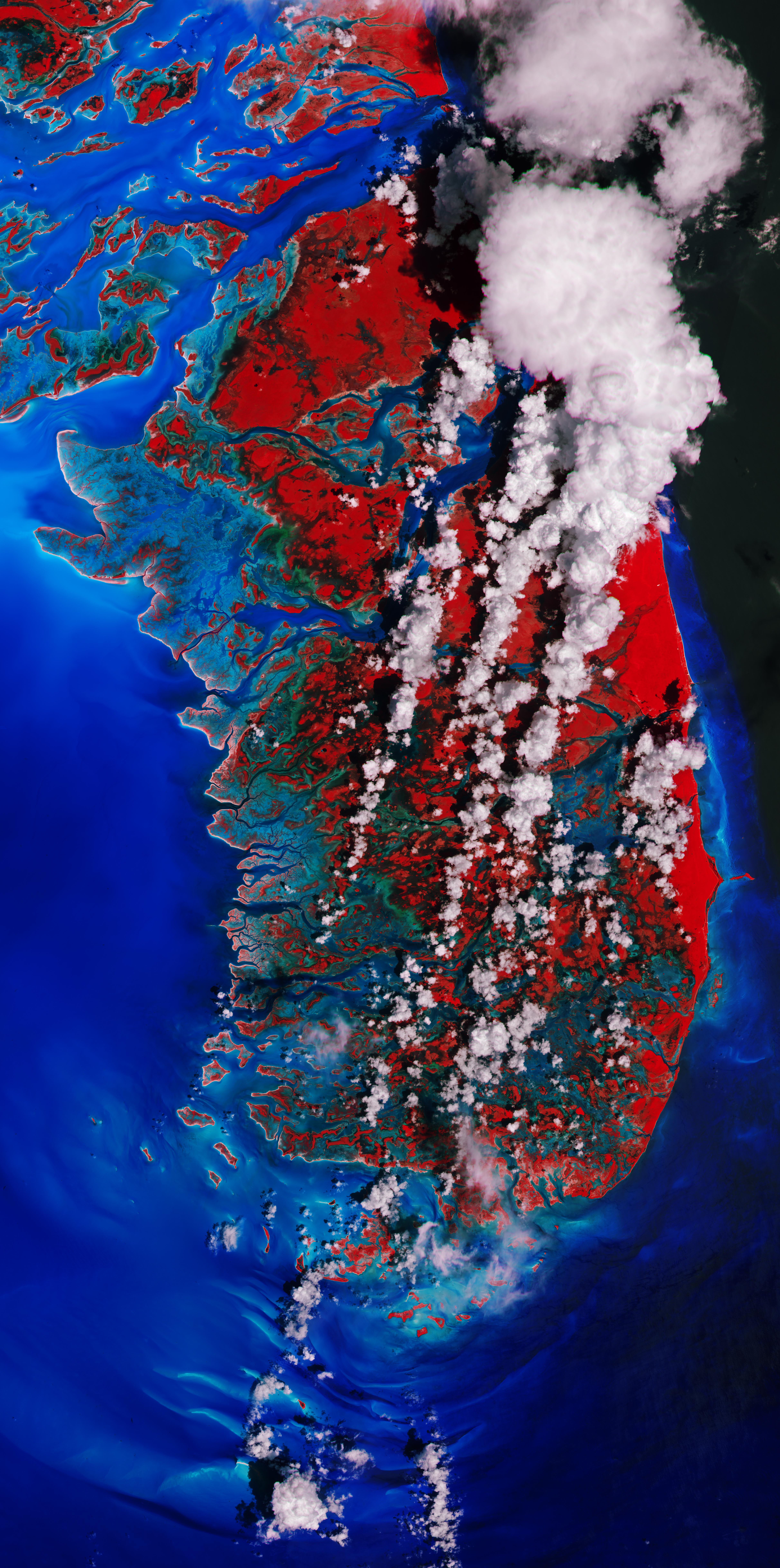
Andros Island, the largest island of the Bahamas, is featured in this false-colour image captured by the Copernicus Sentinel-2 mission. This image was processed in a way that included the near-infrared channel, which highlights the island’s vegetation in bright red.
Andros is around 160 km from north to south, and 70 km from east to west at its widest point. The island is largely unpopulated and has undeveloped stretches of land. Even though it is considered a single island, Andros is an archipelago made up of hundreds of small islets and cays connected by estuaries and swamplands together with three major islands: North Andros, Mangrove Cay and South Andros.
The island’s west coast features many bays, channels and inlets. The turquoise colours of the ocean show shallow waters, whereas the dark blue colours are the deep ocean.

Click on the image to view it at full resolution
The West Side National Park covers the west part of Andros and includes its pristine coastal wetlands. The 6,000 sq km park is the largest protected area in the region,and is a prime habitat for bonefish and an important feeding area for the endangered West Indian flamingo.
This image was acquired on 5 September 2019, just days after the mighty Hurricane Dorian passed over the Bahamas and unleashed a siege of destruction. Dorian is reported to be one of the most powerful Atlantic hurricanes on record – with storm surges, wind and rain that claimed many lives, destroyed homes and left thousands of people homeless.