Gepubliceerd op 28 september 2018
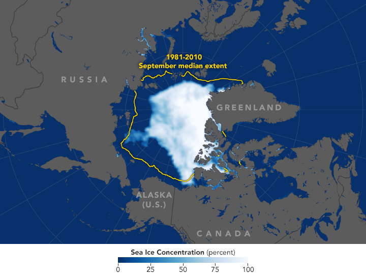
Extent of Arctic sea ice as measured by satellites on September 19, 2018
Arctic sea ice likely reached its annual minimum extent on September 19 and again on September 23, 2018, according to researchers at the National Snow and Ice Data Center (NSIDC) and NASA. Analyses of satellite data showed that the Arctic ice cap shrank to 4.59 million square kilometers (1.77 million square miles), tied for the sixth lowest summertime minimum on record. Researchers at NSIDC noted that the estimate is preliminary, and it is still possible (but not likely) that changing winds could push the ice extent lower.
Arctic sea ice follows seasonal patterns of growth and decay. It thickens and spreads during the fall and winter and thins and shrinks during the spring and summer. But in recent decades, increasing temperatures have led to significant decreases in summer and winter sea ice extents. The decline in Arctic ice cover will ultimately affect the planet’s weather patterns and the circulation of the oceans.
The map above shows the extent of Arctic sea ice as measured by satellites on September 19, 2018. Extent is defined as the total area in which the ice concentration is at least 15 percent. The yellow outline shows the median September sea ice extent from 1981–2010. Extent is defined as the total area in which the ice concentration is at least 15 percent. The yellow outline shows the median September sea ice extent from 1981–2010.