Gepubliceerd op 6 juli 2022
While these images offer little direct consolation for those suffering the burden of heat, they are helping by providing geospatial information to mitigate effects of heatwaves in the future through planning and managing water resources more efficiently.
For ESA, this particular instrument, which is called ECOSTRESS and owned by NASA’s Jet Propulsion Laboratory (JPL), is important because it is helping in the development of a new Copernicus Sentinel satellite: the Land Surface Temperature Monitoring (LSTM) mission.
ESA is using the instrument to simulate the data that will eventually be returned by LSTM, which will provide systematic measurements of the temperature of the land surface, promising to be a game-changer for urban planners and farmers, for example.

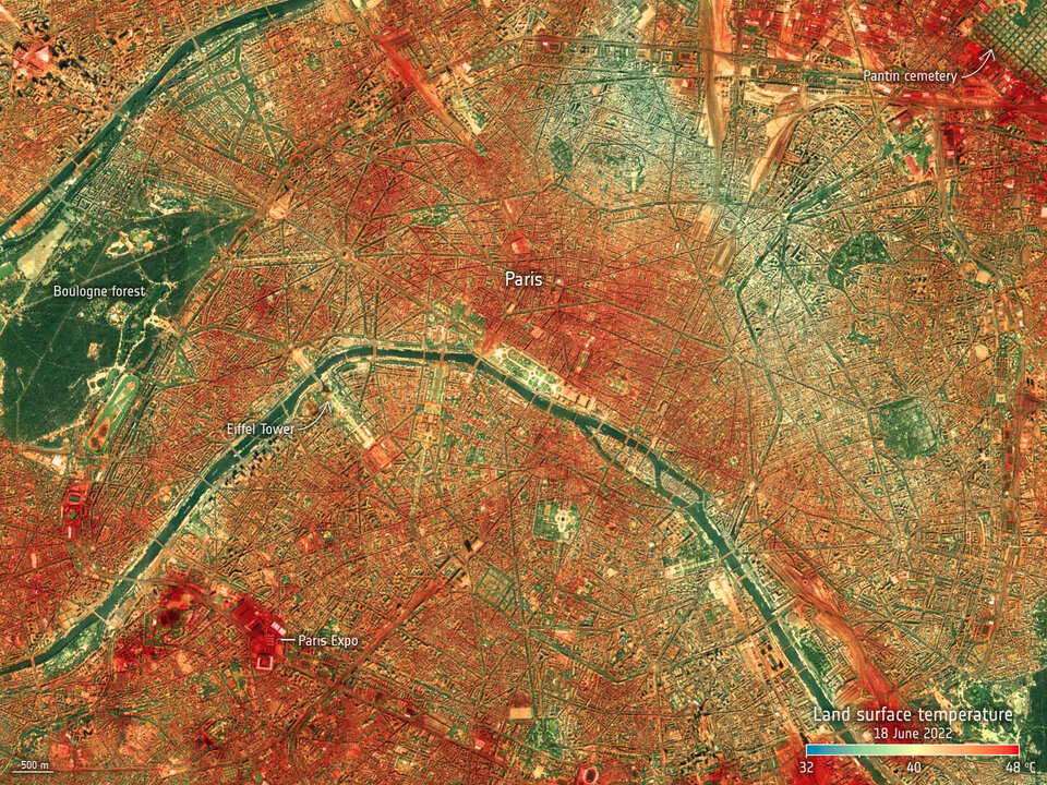
Land-surface temperature in Paris on 18 June 2022
Click here to view this image at its full resolution.
Both space agencies are working together closely to make most use out of the two missions in a synergetic manner, including JPL’s Surface Biology and Geology mission.
In fact, this collaboration is part of the overall objective of working together to lead a response to climate change – the NASA–ESA Framework Agreement for a Strategic Partnership in Earth System Science, which was signed recently.
The world has already warmed by about 1.1°C since the industrial era began and temperatures are set to keep rising unless greenhouse gas emissions are cut drastically.
Heatwaves appear to be increasing in frequency, intensity and duration because of human-induced climate change. June has been a harsh reminder of what is in store.

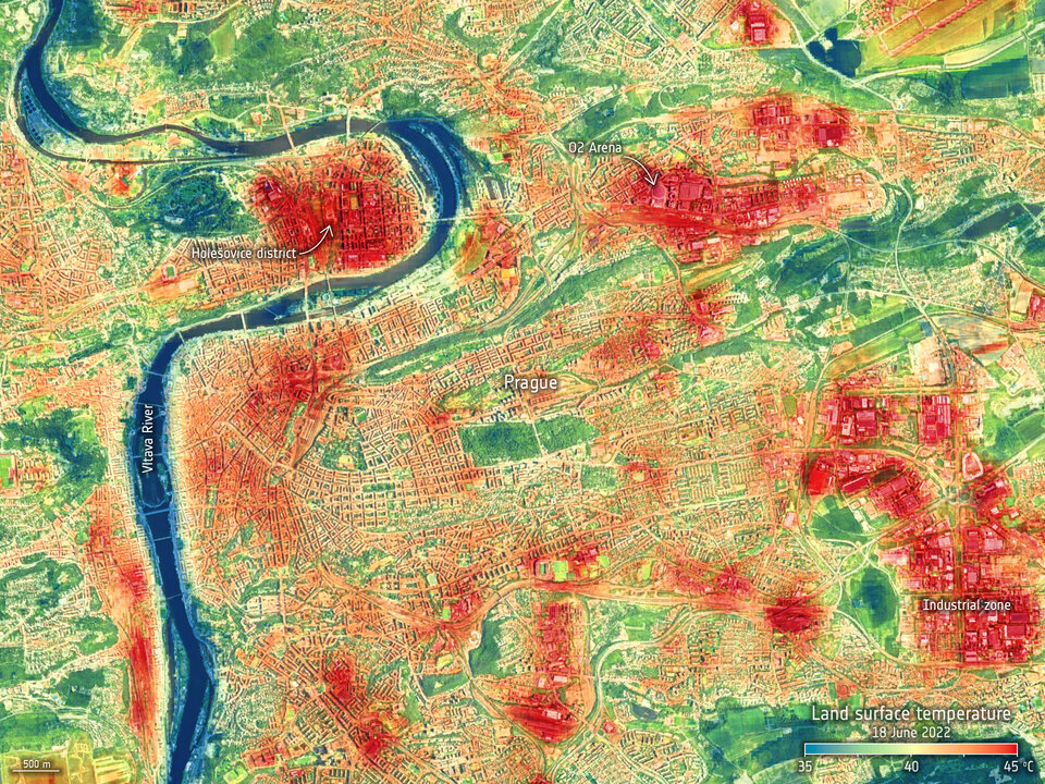
Land-surface temperature in Prague on 18 June 2022
Click here to view this image at full resolution.
For several consecutive days in mid-June, many European cities endured air temperatures above 40°C.
Europe wasn’t alone in its suffering this June. Tokyo in Japan notched up air temperatures above 35°C for five days in a row, making it the worst documented run of hot weather in June since records started in 1875. In the US, by 15 June, nearly one-third of the population was under some form of heat advisory.
The city images here show land-surface temperatures in Milan, Paris and Prague on 18 June in the early afternoon. For comparison the wider view of land-surface temperature across much of Europe below was taken by the Copernicus Sentinel-3 mission on 18 June, slightly earlier in the day.
Read the rest of the article
over on ESA's Observing the Earth website