Gepubliceerd op 27 april 2022
This image, acquired by one of the Copernicus Sentinel-2 satellites on 21 April 2022, shows the village of Höfn on the southeastern coast of Iceland. It is a fishing town with just over two thousand inhabitants located on one of the few natural harbours of the region and near the Vatnajökull, Iceland’s largest ice cap.
As a consequence of climate change, the lagoons surrounding the village are becoming shallower, as the sea level is decreasing. This phenomenon is mainly due to the melting of glaciers: the intense pressure applied on the soil by the nearby ice caps for thousands of years has been diminishing, causing the land to bounce back. Moreover, large glaciers have a gravitational effect on the ocean, pulling water towards them: this decreases as their mass shrinks. These processes have resulted in the tide hitting the shore with less intensity than before, causing the very channels used by fishing boats to fill up with sand. Measurements have shown that the ground in Höfn has been rising by as much as 1.7 centimetres per year.
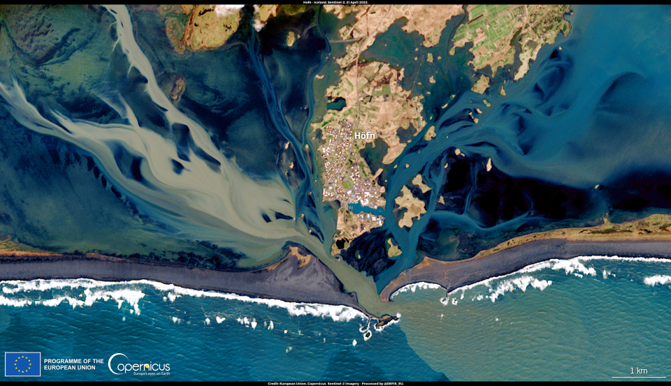
The reduced navigability of the lagoon is affecting fishing opportunities for local fishermen, having a significant impact on the local economy.
The Copernicus Climate Change Service (C3S) provides access to state-of-the-art and quality assured climate information. In addition, data collected by the Copernicus Sentinel-3 and Sentinel-6 Michael Freilich satellites are extremely useful for analysing sea-level rise and assessing the effects of climate change has on it.