Gepubliceerd op 25 november 2021
However, satellite data from operational and non-operational ESA missions provide long-term Earth observational records, giving essential context to current climate variability. The region of High Mountain Asia extending from the Himalayas to the Hindu Kush, held centre stage at the Climate Change Conference since temperatures there are rising three times faster than global averages.
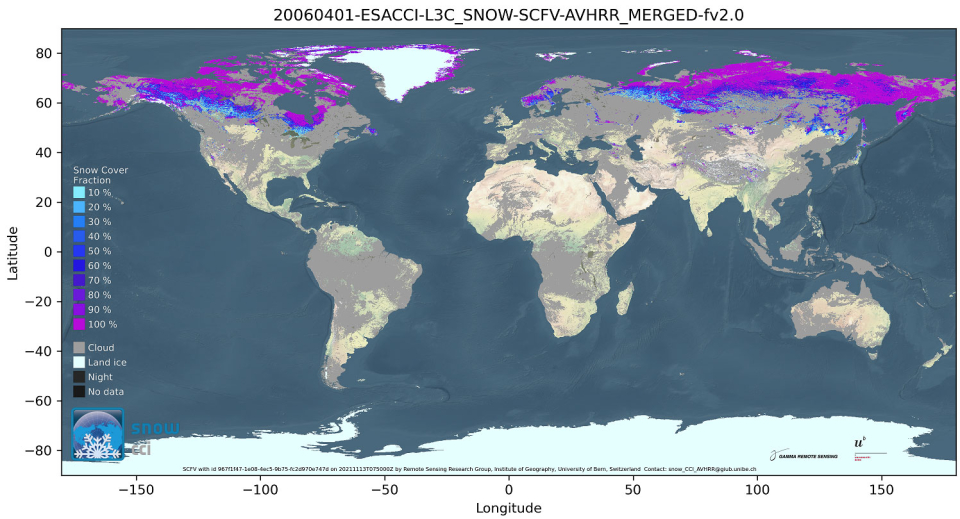
Recent research by the Remote Sensing Research Group (RSGB) and the Oeschger Centre for Climate Change Research at the University of Bern, used existing Advanced Very High Resolution Radiometer (AVHRR) data to explore this disproportionate regional effect of the climate emergency on seasonal snow cover. These researchers are specialised in retrieving Essential Climate Variables (ECVs) from AVHRR data, leveraging the advantage of data acquired over Europe and globally for nearly 40 years, today archived and managed at ESA as part of its Heritage Space Missions portfolio.
Global viewable fractional snow cover
"Crucial to making progress on climate change is to use a climate relevant timescale, which is the real advantage of Heritage Missions," said lead researcher, Dr Kathrin Naegeli. "The AVHRR dataset was of particular interest since in order to produce ECV timeseries that are characterised by high temporal and spatial variability, we needed daily resolution over a long-time scale."
The resulting ECV product, “Daily global snow cover product” is the longest-term snow cover product, covering the period 1982–2020 at a daily temporal and 0.05◦ spatial resolution, and was used by climate modellers from the University of Grenoble to make future predictions for the region.