Gepubliceerd op 4 november 2024
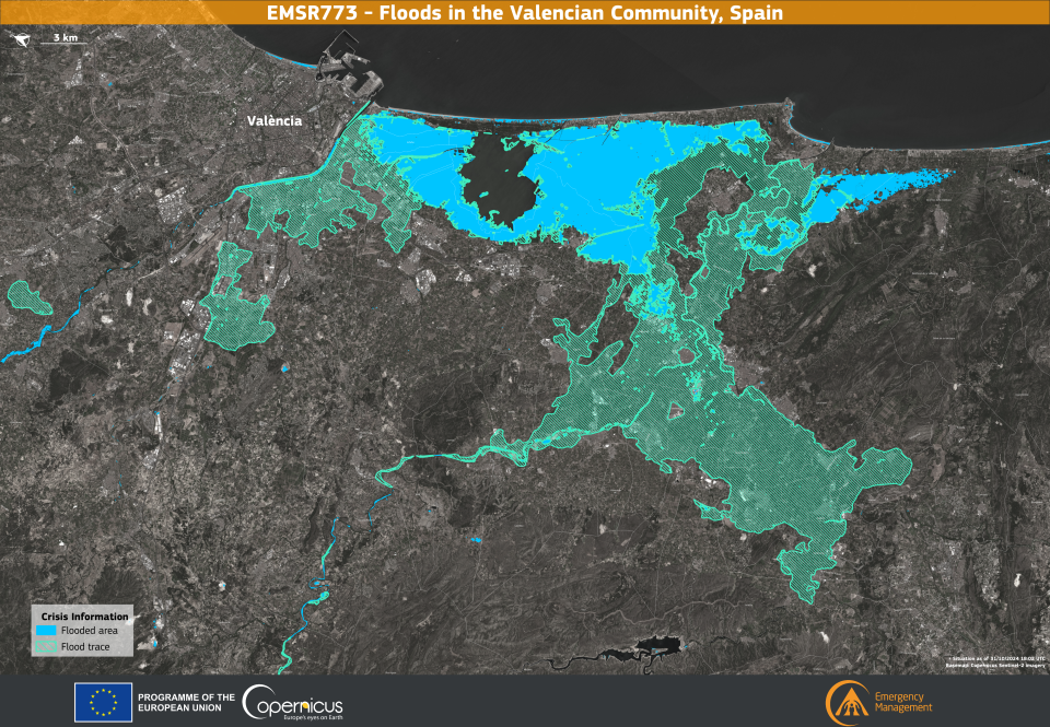
On 29 October 2024, the Community of Valencia in Spain has been hit by severe flooding, causing widespread devastation and the tragic loss of more than 200 lives. In response to the crisis, the Copernicus Emergency Management Service (CEMS) has been activated (EMSR773) to provide a comprehensive assessment of the extent of the flooding in the affected areas.

This data visualisation depicts the situation in the province of Valencia on 31 October 2024 at 18:02 UTC. It highlights areas directly affected by the floods, marked in blue, and areas with residual flood traces, indicated by light green lines. The map reveals that more than 53,000 hectares were affected by the floods, with more than 190,000 people and 3,200 km of roads potentially affected. More information is available here.
This information is essential for emergency response and future mitigation planning, demonstrating the essential role of Copernicus data in managing crises caused by extreme weather events.
Source:
Copernicus. (2024, November 3). The Copernicus Emergency Management Service monitors the floods in Valencia, Spain . Image of the Day.