Gepubliceerd op 13 mei 2022
It is estimated that irrigated agriculture accounts for about 70 percent of water withdrawn globally from lakes, rivers and aquifers, representing the largest human-induced impact on the water cycle. However, obtaining high-quality global information about the extent and frequency of irrigation is challenging.
Using multi-mission Earth observation data, the research of the Irrigation+ Project, a project within ESA’s EO Science for Society, aims to advance the worldwide mapping and quantification of irrigation in the agricultural sector. The consortium, led by the Hydrology group at the Research Institute of the Geo-Hydrological Protection (CNR-IRPI), has already within two years published 16 peer-reviewed scientific papers, which leverage advanced Earth observation algorithms and techniques for irrigation mapping, quantification and detection.

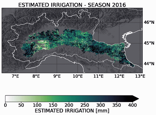
Animation showing annual water use for irrigation
In the last ten years there has been a substantial improvement in remote sensing techniques for irrigation mapping and quantification. A newly published paper from the project reviews this landscape, highlighting the contribution of the Sentinel-1 and Sentinel-2 satellites of the European Union’s Copernicus Programme. "Tracking irrigation at field scale and estimating irrigation water use, requires high resolution observations, such as those obtained from the Copernicus Sentinel-1 and Sentinel-2 satellites,” says Luca Brocca, of CNR-IRPI, the principle investigator of the Irrigation+ project.