Gepubliceerd op 16 maart 2021
Dust storms commonly occur across Asia in springtime. But meteorological spring is just getting underway, and already an enormous plume of sand and dust has blanketed northern China. It has been called the largest and strongest such storm to strike the region in a decade.
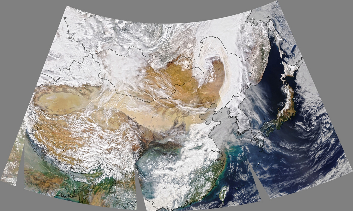 The dust is visible in this natural-color image, acquired on March 15, 2021, with the Moderate Resolution Imaging Spectroradiometer (MODIS) on NASA’s Aqua satellite.
Click to view the image at full resolution

The plume appears to originate from the Taklamakan Desert in northwest China. The dry, barren area is a major source of airborne dust that can travel especially high and far on the strong winds of spring. From the Taklamakan, the dust moved eastward for thousands of kilometers.
“Using NASA’s satellite data, we’re able to track the dust’s pathways,” said Hiren Jethva, a Universities Space Research Association (USRA) scientist based at NASA’s Goddard Space Flight Center. In addition to natural-color imagery, Jethva tracks dust and smoke using satellite measurements of the UV aerosol index. Those data indicate that the dust moved along a west-to-east path. It then turned, following a cyclonic circulation in the atmosphere, and was lofted to an altitude above the cloud layer. Scientists have previously showed that aerosols above the clouds can have important consequences for the climate.