Gepubliceerd op 2 juni 2023
On ESA's Earth from Space website, you can zoom in on the image to explore it at its full 10 m resolution or click on the circles to learn more.
Anchorage is visible in grey in the centre of the image. It lies in southcentral Alaska at the head of the Cook Inlet, between the Turnagain Arm stretching southeast and the Knik Arm stretching northeast. The sandy colour of waters illustrates how much sediment and debris are being transported into the inlet.
South of Anchorage, on the southern side of the Turnagain Arm, lies the Kenai Peninsula. The northwest of the peninsula is flat and dotted with numerous small lakes, while the east is home to the Kenai Mountains.
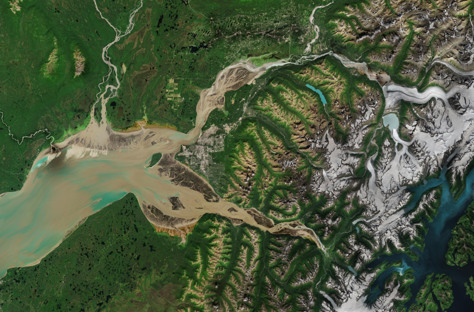
The snow-covered Chugach Mountains, which can be seen on the right of the image, hold the state’s largest concentration of glacial ice. When warm, wet air flows off the Pacific Ocean and meets the cool temperatures of this mountain range, some of the highest snowfall in Alaska is created.
The largest glacier visible in the image is Knik Glacier, an ice field snaking from the northern end of the Chugach Mountains. It measures about 40 km in length and over eight km across, making it one of the largest in southcentral Alaska.
Depending on the different concentrations of ice melting from the Chugach Mountains, glacial lakes and water bodies appear in various tones of cyan, light and dark blue.
Source:
European Space Agency (ESA). (2023c, June 2). Earth from Space: Anchorage, Alaska. Earth From Space.