Gepubliceerd op 14 februari 2023
A devastating 7.8 magnitude earthquake has hit Türkiye and Syria. The damage is considerable, with at least 33,000 casualties.
The earthquake was so strong that it caused massive ground deformations. This interferogram was created using the radar data acquired by the Copernicus Sentinel-1 satellite in ascending orbit on 28 January and 9 February.
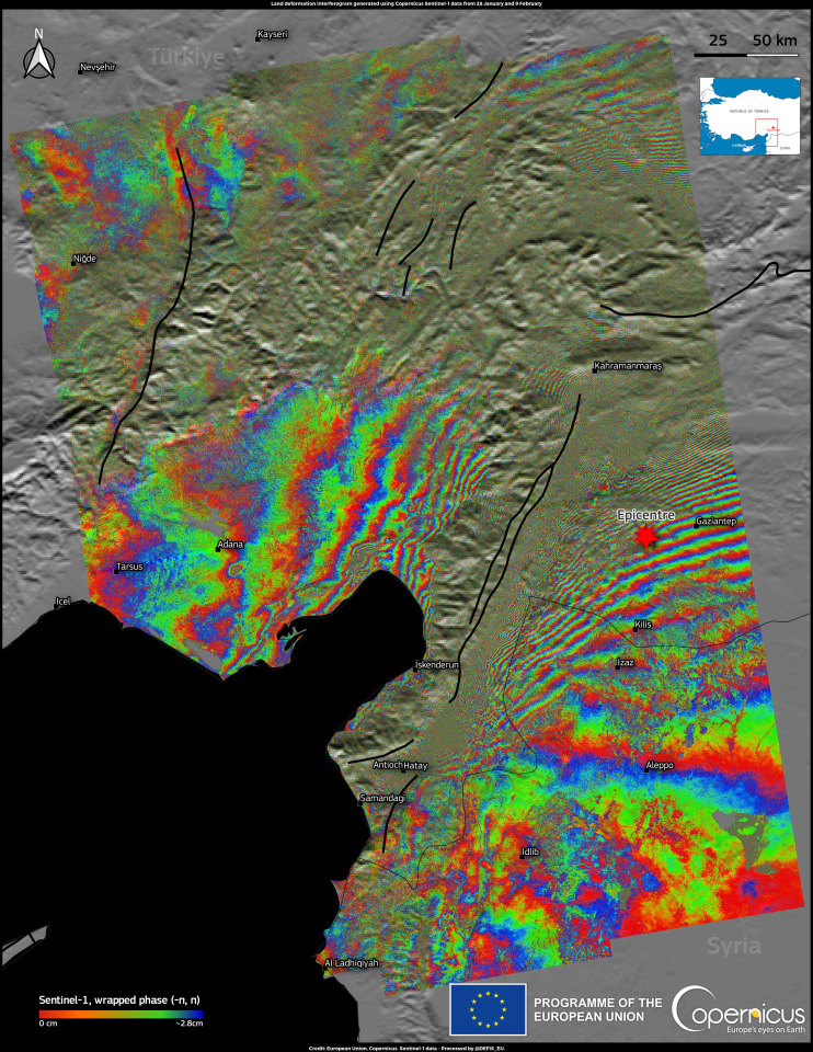
The areas with the greatest displacement are those close to the Anatolian fault, where analysis of the radar data indicates a displacement along the satellite's line of sight of about 4 metres.
The Rapid Mapping module of the Copernicus Emergency Management Service has produced detailed damage grading maps of the areas impacted. All the Rapid Mapping products are available here.
Source:
Copernicus. (2023e, February 13). Earthquake in East Anatolian Fault Zone. Image of the Day.