Gepubliceerd op 19 maart 2021
As its name implies, the Amazonas is almost entirely covered by the Amazon rainforest – the world’s largest tropical rainforest covering an area of around six million sq km. The Amazon is the world’s richest and most-varied biological reservoir, containing several million species of insects, birds, plants and other forms of life.
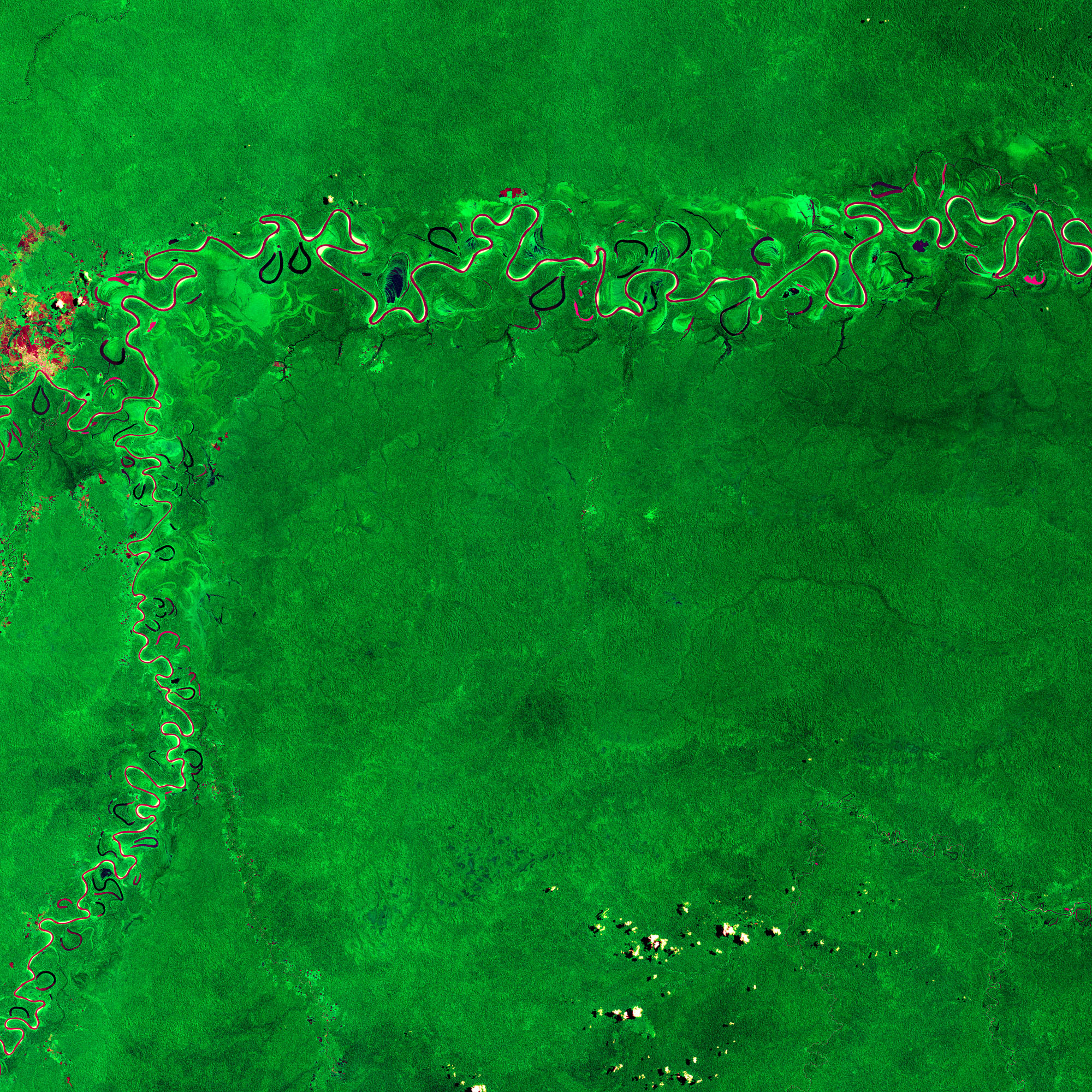
This image has been processed using the infrared channel of Copernicus' Sentinel-2 satellite which makes the dense rainforest appear in bright green. This makes differences in vegetation coverage more evident than only using the visible channels of the satellite that our eyes are able to see.
 Click on the image to explore it in its full 10 m resolution and learn about the features in this stunning landscape.
In the top of the image, the Juruá River, the most-winding river in the Amazon basin, is visible. The river appears in shades of maroon and magenta as the reflected sunlight from the water’s surface consists of a mix of mainly blue and green, while the reflection in the near infrared is almost zero – leading to the colours we see here.
The Juruá river, which flows more than 3000 km before emptying into the Amazon River, is turbid with relatively high nutrient levels. The river rises in the highlands in east-central Peru before winding its way through lowlands in Brazil.
Several crescent-shaped oxbow lakes can be seen flanking the river. Oxbow lakes are generally formed when rivers cut through a meander ‘neck’ to shorten its course, causing the old channel to be blocked off – migrating away from the lake and creating a more direct route.