Gepubliceerd op 10 maart 2022
Satellites orbiting Earth from pole to pole don’t actually fly directly above the North and South Poles. This leaves two small circular gaps in the global data. To fill in these missing measurements for ESA’s GOCE gravity satellite mission over the South Pole, an international team of scientists joined forces to take a multitude of measurements from aircraft as part of an ESA campaign called PolarGAP.
The GOCE mission mapped Earth's gravity with unrivalled precision and provided the most accurate model of the ‘geoid’ ever produced to further our understanding of how Earth works.
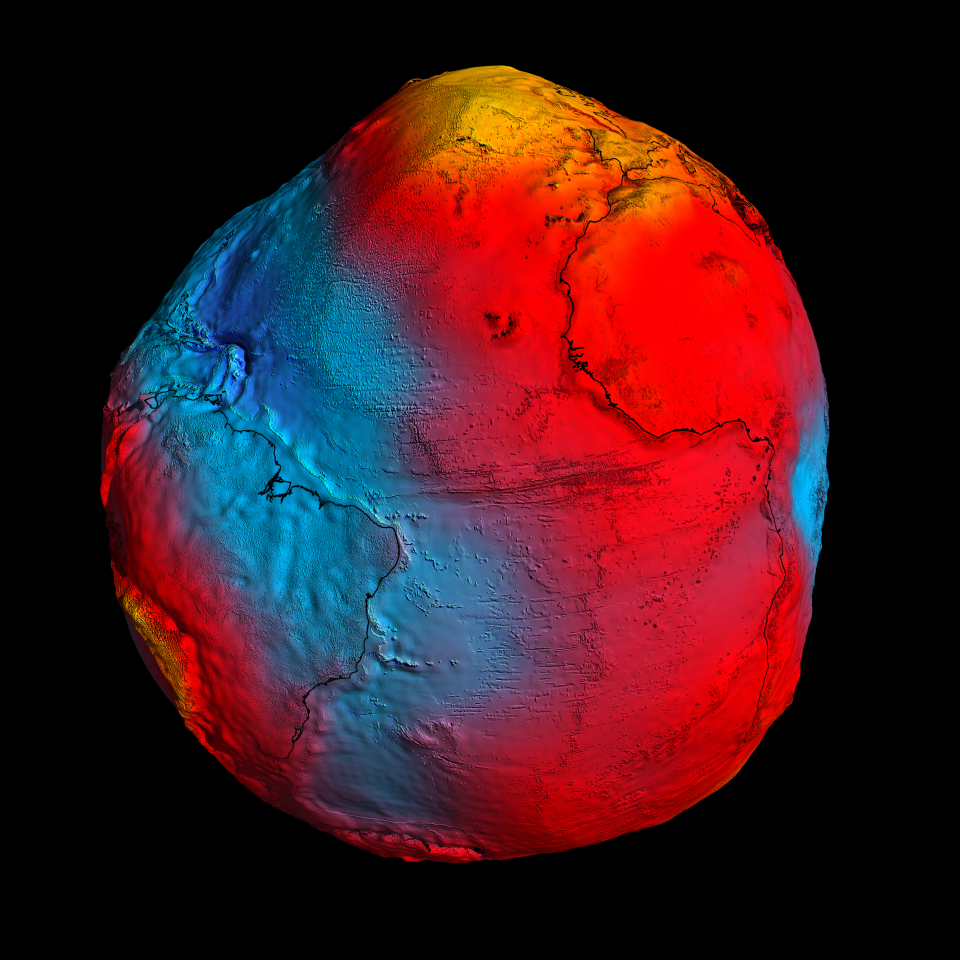
New GOCE geoid
Click here to view the image at full resolution.
The geoid is the surface of equal gravitational potential defined by the gravity field – crucial for deriving accurate measurements of ocean circulation and sea-level change, both of which are affected by climate change.
It was therefore important to fill in the measurements that GOCE could not take at the poles owing to its orbit.
As well as supplying these missing data for GOCE, the PolarGAP team has yielded new insights into the hidden geology at South Pole, shedding new light on the extent and shape of the edge of East Antarctica.