Gepubliceerd op 9 juni 2022
The French government recently published a decree which lists the 126 French municipalities at high risk of coastal erosion. According to media sources, this represents one-fifth of the country’s coastline. As a result of the new Climate and Resilience law, the municipalities listed in the decree are expected to adopt specific measures to adapt to the effects coastal erosion fuelled by climate change, sea-level rise and anthropogenic pressure.
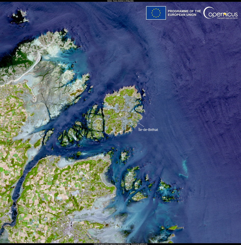
This image, acquired by one of the Copernicus Sentinel-2 satellites on 29 May 2022, shows Île-de-Bréhat, off the northern coast of Brittany, one of the most threatened sites.
Click here to view the image at full resolution.
The Copernicus Marine Environment Monitoring Service (CMEMS) and the Copernicus Land Monitoring Service (CLMS) are working closely together on a comprehensive coastal monitoring service to address the complex dynamics of coastal erosion, whereas the Copernicus Climate Change Service (C3S) supports adaptation and mitigation policies by providing consistent and authoritative information about climate change dynamics and consequences.
Check out this and tons of other fascinating images
over on the Copernicus Image of the Day website