Gepubliceerd op 4 november 2020
Tiny shifts in the land surface across the whole of Germany have been mapped for the first time, with the help of the Copernicus Sentinel-1 radar mission.
Land-surface deformation, such as subsidence, often happens because of changes that take place underground such as groundwater extraction, mining, natural consolidation of sediments and rapid urbanisation.
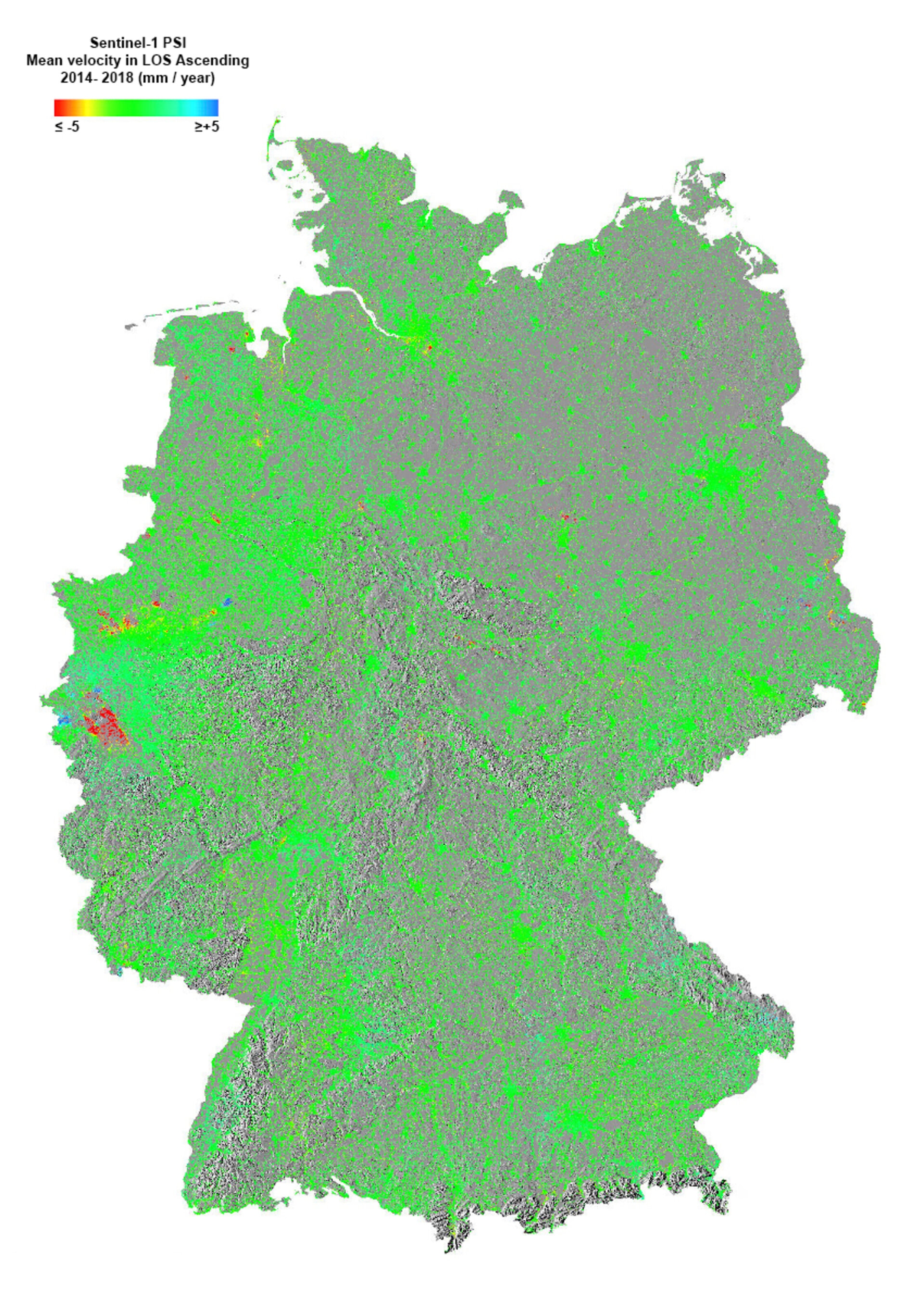
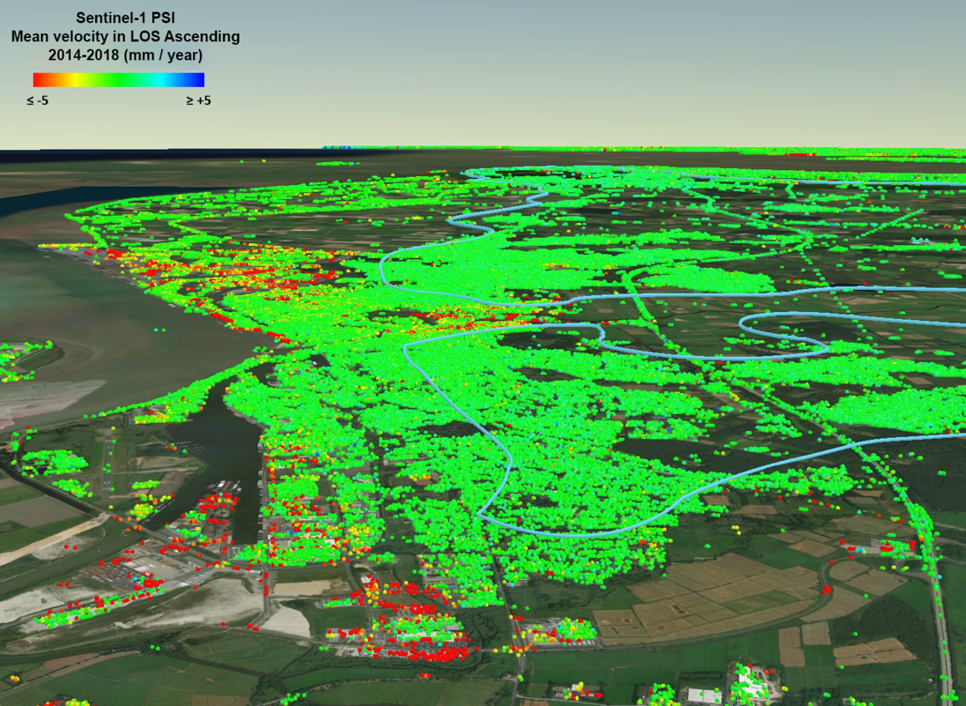
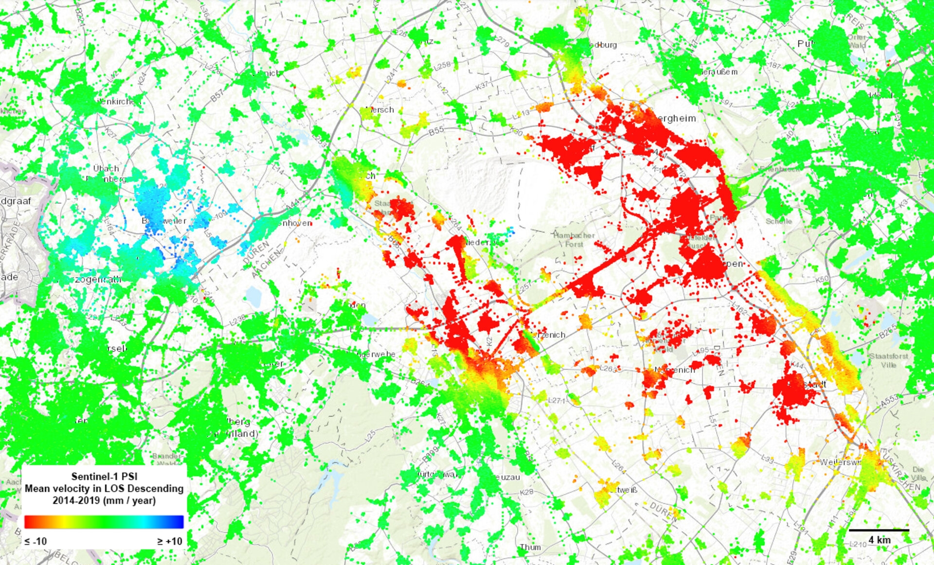
This ground motion can be a major threat, in both urban and agricultural areas, where continuous shifts over time can cause, for example, damage to buildings, roads, bridges, dykes and other infrastructure, and can cause changes in the way surface water flows and accumulates – all of which has economic implications.
Urban development projects and risk assessment efforts rely on ground-motion monitoring, which is usually supplied by terrestrial surveying methods. Images from space, however, offer cost-effective, systematic, high-precision measurements over most of Earth’s land surface.