Gepubliceerd op 17 april 2019
On April 15, 1999, Landsat 7 first made its way into space. 106,380 orbits later, the 2.6 million images acquired by Landsat 7 have given us a fuller and more nuanced understanding of Earth.
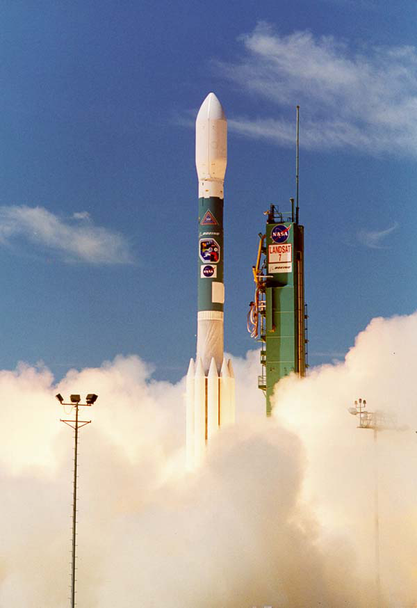
Landsat 7 launched from Vandenberg Air Force Base in California on April 15, 1999. Photo credit: NASA
Take for example the Millennium Coral Reef Mapping Project. In 2006, Landsat 7 data were used to create a first-of-its kind global survey of coral reefs. The research lead on this project, Frank Muller-Karger, commented in 2015: “Until we made the map of coral reefs with Landsat 7, global maps of reefs had not improved a lot since the amazing maps that Darwin drafted.”
Landsat 7 data, together with data from its predecessor Landsat 5, provided the most comprehensive assessment ever of Earth’s mangroves in 2010.
And for the International Polar Year (2007-2008), data from more than 1,000 Landsat 7 images were used to create the Landsat Image Mosaic of Antarctica (LIMA)—what was then the most detailed satellite mosaic of Antarctica.