Gepubliceerd op 30 mei 2024
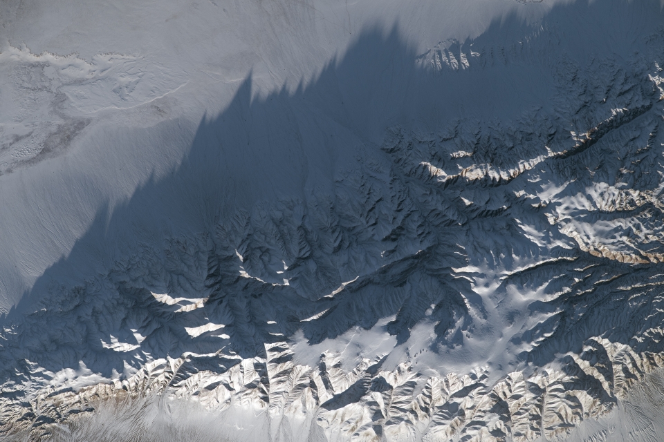
While orbiting over central Mongolia, an astronaut aboard the International Space Station (ISS) captured this image of the snow-covered Gobi Altai Mountains and neighboring plains.
Late-afternoon sunlight casts long shadows of mountain peaks onto the plains below. Numerous steep gullies cut into the massif, or mass of mountains, whose rugged appearance contrasts with the flat plains stretching along the top of the image. The plains are a semidesert grassland, or steppe, which provides pasture for livestock herders in the region.
Part of a small dry lake appears in the top left of the image. In wetter years, water from this lake feeds Orog Lake (also photographed by astronauts), out of frame to the upper right. This and other nearby lakes are part of the Valley of Lakes waterfowl conservation habitat, protected as a Ramsar site.

In central Asia, jagged mountain peaks rise high above the steppe.
View the image at full resolution.
In addition to horses, cattle, camels, goats, and sheep, Mongolia is home to the yak–cattle hybrid known as the yakow (khainag in Mongolian). Since 2000, four harsh winters have caused significant loss of livestock, mainly due to unusually deep snow or ice preventing access to grass. Flock sizes had grown rapidly after 1990, increasing the number of animals vulnerable to severe winters.
The grassland surrounding the massif is classified by scientists as a cold semidesert, located at an elevation of about 1,250 meters (4,100 feet) above sea level. Annual temperatures are even colder on the massif’s mountain peaks, the highest of which—Ikh Bogd (also known as Tergun Bogd)—reaches nearly 4,000 meters (13,000 feet). The climate on the peaks is classified as a polar tundra because the average annual temperature is below freezing. Asia’s main tundra zone is located in Siberia, along the coast of the Arctic Ocean, 2,800 kilometers (1,750 miles) to the north.
More astronaut photography of mountainous central Asia in winter is available here.
Astronaut photograph ISS070-E-80527 was acquired on January 25, 2024, with a Nikon D5 digital camera using a focal length of 400 millimeters. It is provided by the ISS Crew Earth Observations Facility and the Earth Science and Remote Sensing Unit, Johnson Space Center. The image was taken by a member of the Expedition 70 crew. The image has been cropped and enhanced to improve contrast, and lens artifacts have been removed. The International Space Station Program supports the laboratory as part of the ISS National Lab to help astronauts take pictures of Earth that will be of the greatest value to scientists and the public, and to make those images freely available on the Internet. Additional images taken by astronauts and cosmonauts can be viewed at the NASA/JSC Gateway to Astronaut Photography of Earth. Caption by Justin Wilkinson, Texas State University, JETS Contract at NASA-JSC.
Source:NASA. (2024, May 26). Long shadows of Mongolian mountains. NASA Earth Observatory. |