Gepubliceerd op 14 oktober 2021
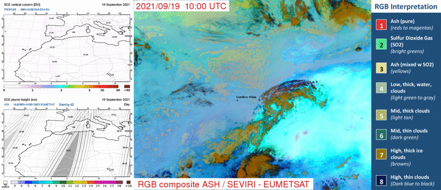
TROPOMI SO2 vertical column density (upper left), IASI SO2 plume height (lower left), and SEVIRI Volcanic Ash composite (right). The Cumbre Vieja location is indicated in the right panel by the red triangle, the various false-color composite interpretations are indicated to the right. The time tags in the TROPOMI and IASI panels denote the satellites’ overpass times (in UTC) at the given locations.
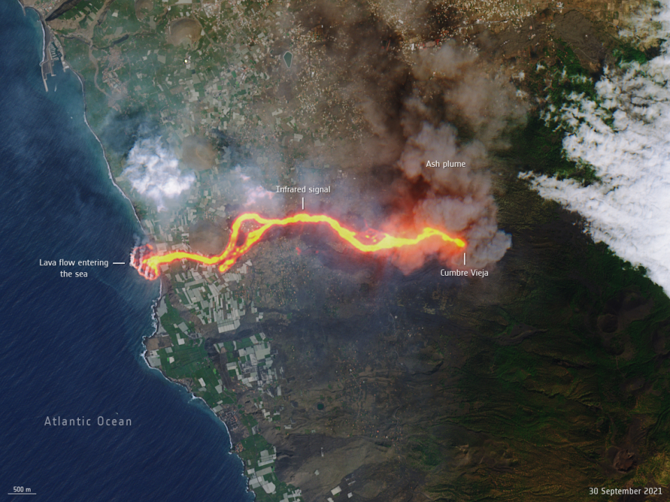
This image, captured by the Copernicus Sentinel-2 mission on 30 September, shows the flow of lava from the volcano erupting on the Spanish island of La Palma. The cascade of lava can be seen spilling into the Atlantic Ocean, extending the size of the coastline. This ‘lava delta’ covered about 20 hectares when the image was taken.
The Tropospheric Ozone Monitoring Instrument (TROPOMI) onboard the Copernicus satellite Sentinel-5P provides observations from which the atmospheric SO2 amount can be obtained at an unprecedented 3.5 × 5.5 km2 spatial resolution. However, SO2 is also observed by other sensors, such as the Infrared Atmospheric Sounding Interferometer (IASI) onboard the MetOp satellites and the Spinning Enhanced Visible and Infrared Imager (SEVIRI) onboard the geosynchronous Meteosat satellites, both operated by EUMETSAT.
Read the rest of the article to discover how
SO2 transport is being monitored with three satellites