Gepubliceerd op 9 december 2019
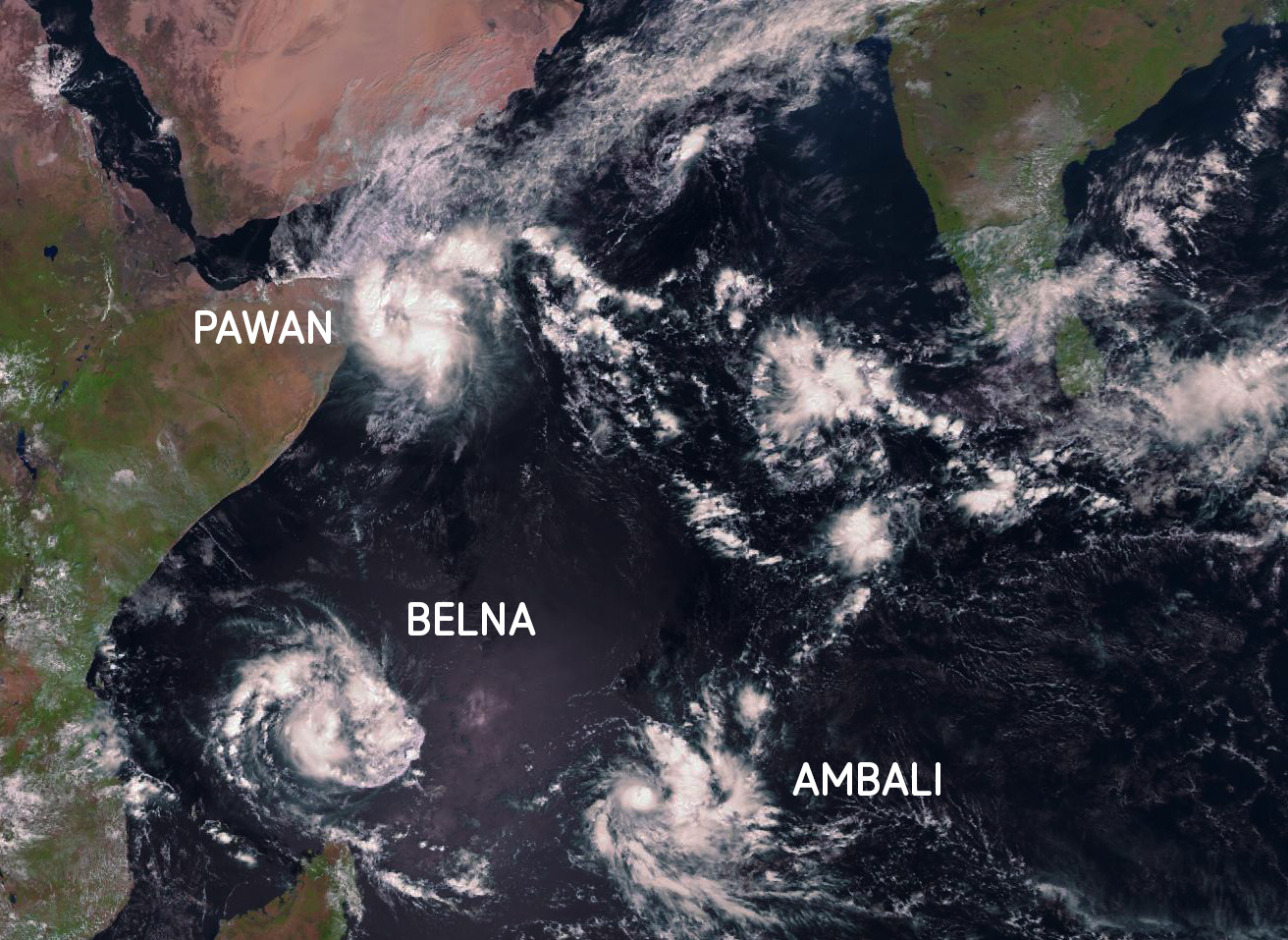
In this image, taken by EUMETSAT's Meteosat-8 on December 6th, 2019, we can see three tropical cyclones in one frame.
Tropical cyclones are intense, rotating storm weather systems with wind speeds so high that they can cause extensive damage and loss of life. In the Indian Ocean they are called "tropical cyclones", as is the case here. The same weather phenomenon gets called a "hurricane" in the Atlantic Ocean and off the United States west coast, and they're called "typhoons" everywhere else in the Pacific. The way they are formed is identical however, as is their devastating effect on property and human lives. If you're interested in their formation mechanisms and their ever-growing potential for damage, be sure to check out our dedicated article.
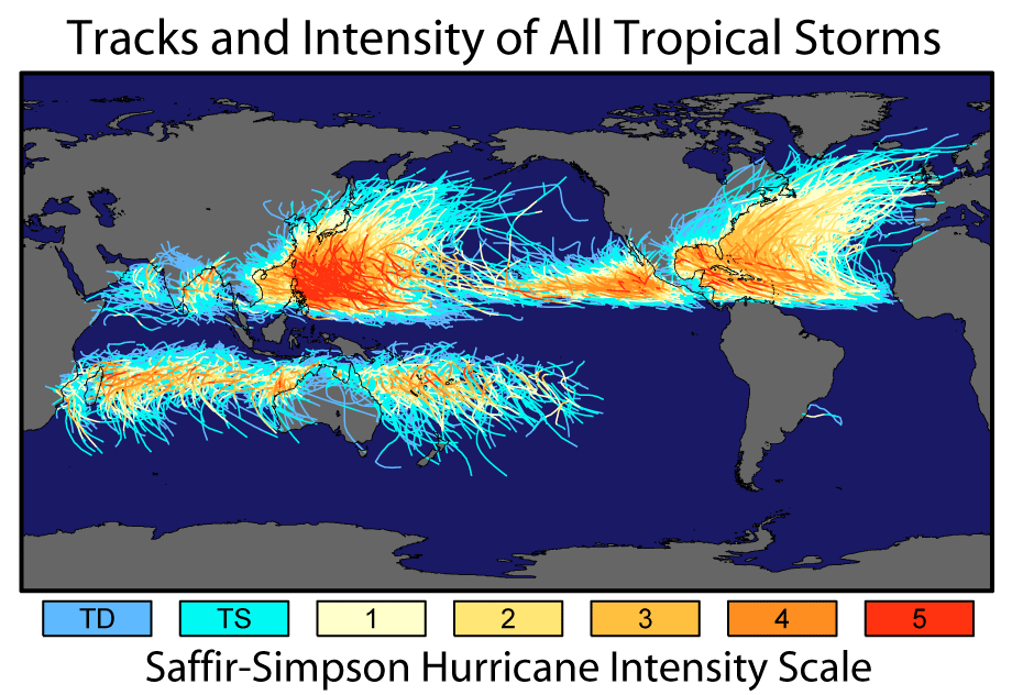
This second image, taken from a NASA article on Historic Tropical Cyclone Tracks, illustrates how tropical cyclones generally develop in two distinct bands around the equator where weather and ocean water conditions are just right, and then gradually bend off towards the poles. The tropical cyclone Pawan, as seen in the first image, clearly belongs to the northern band, while Belna and Ambali, currently closing in on Madagascar, are part of the smaller southern band of tropical cyclones.
For more images by EUMETSAT, covering everything from hurricanes over wildfires to polar ice caps, be sure to check out their account on Flickr.

