Gepubliceerd op 11 augustus 2020
On August 4, 2020, a devastating explosion rocked the port area around Beirut, Lebanon. After the event, scientists used satellite radar imagery to map the extent of the damage and help identify areas where people may need assistance.
According to the Associated Press, a fire near the port ignited a large nearby store of ammonium nitrate, a highly explosive chemical often used in fertilizer. At least 135 people died, about 5,000 were wounded, and at least 300,000 people were left homeless. Losses from the blast are estimated to be at least $10 to $15 billion, according to news reports.
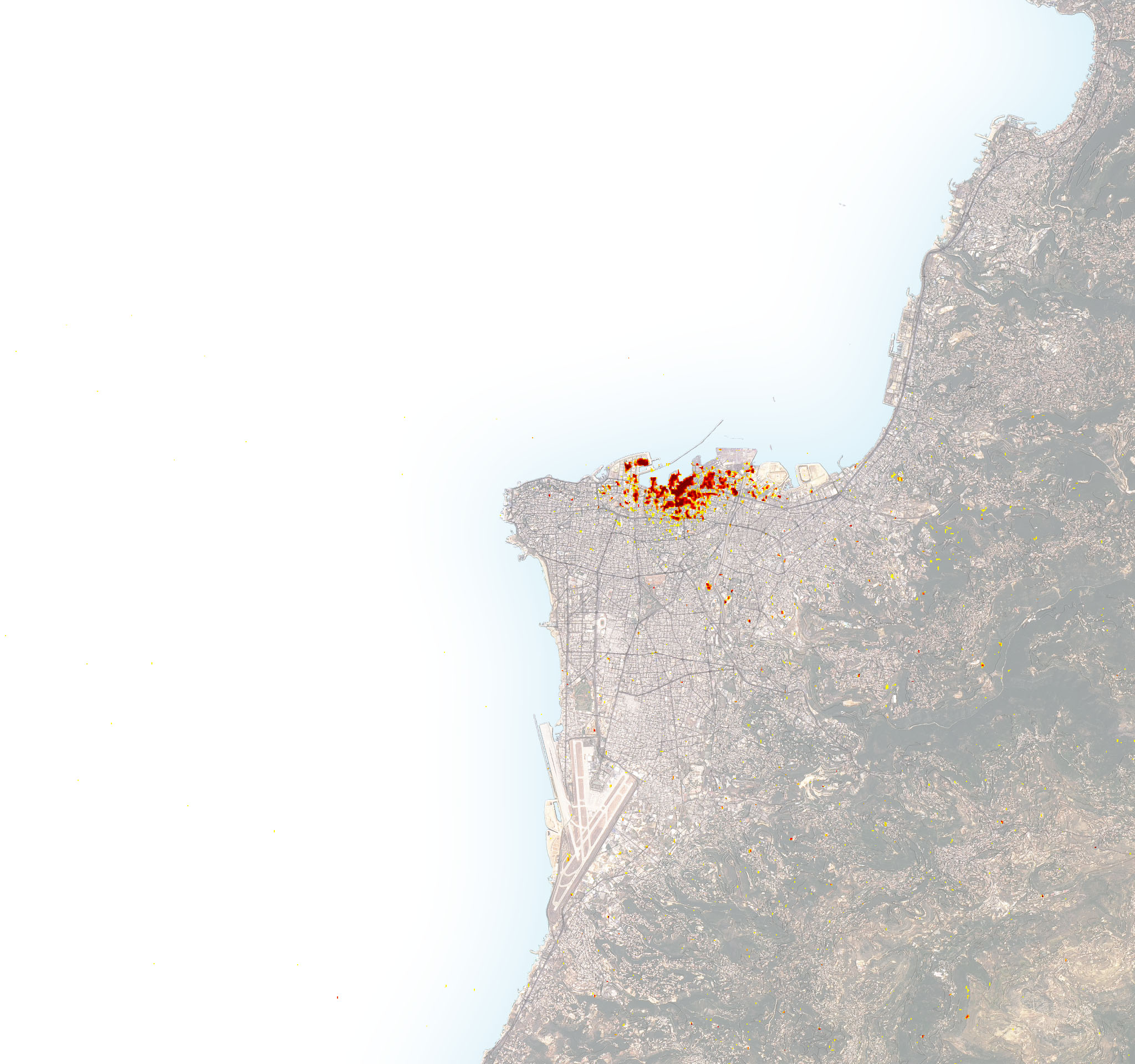
The image above is a damage proxy map created by scientists affiliated with NASA’s Advanced Rapid Imaging and Analysis (ARIA) team and the Earth Observatory of Singapore (EOS). Dark red pixels represent the most severe damage, while orange and yellow areas are moderately or partially damaged. Each colored pixel represents an area of 30 square meters (about the size of a baseball diamond).