Gepubliceerd op 10 december 2020
Sentinel-6 Michael Freilich was lofted into orbit on 21 November from California. After it had sent back its first signal showing that it was alive and well in space, ESA’s Operations Centre in Germany took care of the satellite’s first few days in orbit before handing it over to EUMETSAT for commissioning, and eventual routine operations and distribution of data.
The satellite carries Europe’s latest radar altimetry technology to extend the long-term record of sea-surface height measurements that began in the early 1990s.
On 30 November, flight operators switched on Sentinel-6’s Poseidon-4 altimeter instrument, which was developed by ESA. Analysing its initial data, specialists were astonished by the quality. These first data were presented today, by way of three main images, at the European Space Week.
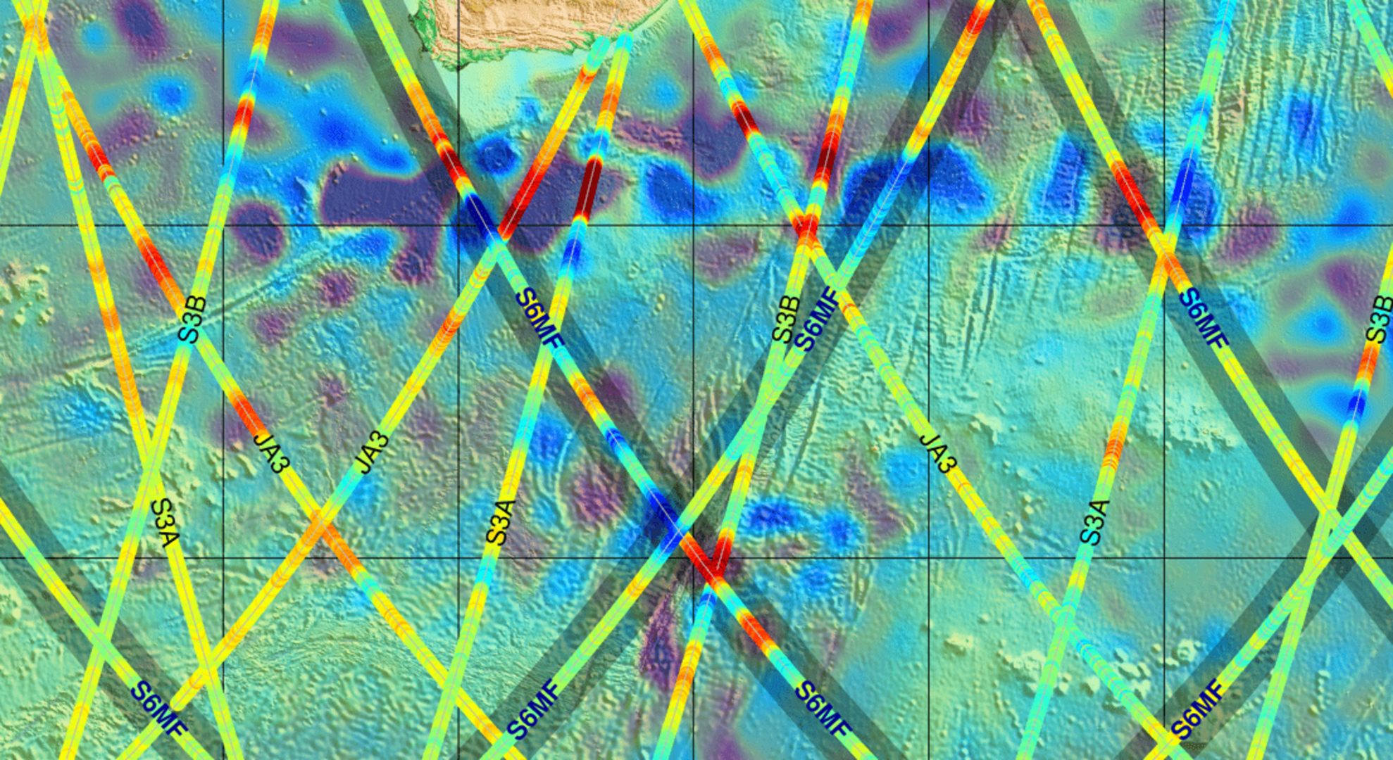
First sea-level height results from Copernicus Sentinel-6 (click to view at full resolution)
The image above shows some preliminary results of sea-surface height. The data are overlaid on a map showing similar products from all of the Copernicus altimetry missions: Jason-3, Sentinel-3A and Sentinel-3B. The background image is a map of sea-level anomalies from satellite altimeter data provided by the Copernicus Marine Environment Monitoring Service for 4 December 2020. The Sentinel-6 data products were generated on 5 December.
More information:
New Copernicus satellite to monitor sea-level rise lofted into orbit
Gelanceerd: Sentinel-6, de nieuwe Copernicus-satelliet voor de monitoring van de zeespiegelstijging