Gepubliceerd op 20 november 2021
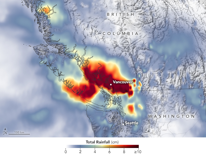
The map below depicts a satellite-based estimate of rainfall over the 24-hour period on November 14—a day that broke numerous records. The darkest reds reflect the highest rainfall amounts, with some places receiving as much as 10 centimeters (4 inches) or more during this period (the top of our scale). The data are remotely sensed estimates that come from the Integrated Multi-Satellite Retrievals for GPM (IMERG), a product of the Global Precipitation Measurement (GPM) satellite mission. Local rainfall amounts can be significantly higher when measured from the ground.
Based on data from GPM – IMERG and Sentinel-2
On November 14, the airport gauge in Hope, British Columbia, collected 17.4 centimeters (6.8 inches) of rain. Vancouver measured 5.3 centimeters (2 inches) that day. Both cities set new daily records. The airport in Bellingham, Washington, reported 7 centimeters (2.8 inches), the fifth-wettest day on record. Almost 2 more inches fell the following day, breaking the city’s two-day rainfall record.
Read the rest of the article
on NASA's Earth Observatory website