Gepubliceerd op 30 september 2022
Tropical Storm Hermine hit the archipelago of the Canary Islands, Spain during the last weekend of September. Torrential rain and winds in excess of 100 km/h caused the cancellation of more than 600 flights and widespread flooding.
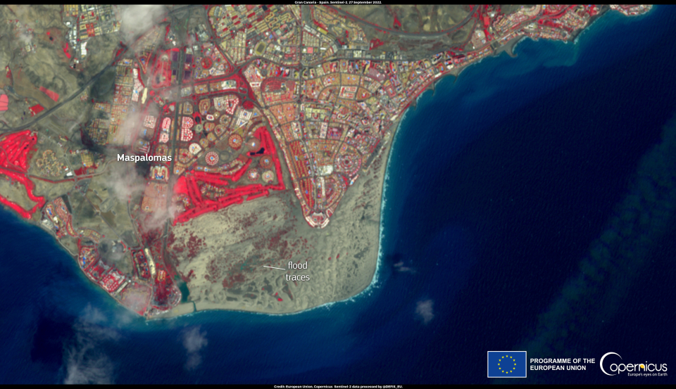
The island of Gran Canaria was particularly affected with more than 100 mm of rain falling in a few hours. As shown in this image acquired by one of the Copernicus Sentinel-2 satellite on 27 September, two days after Hermine's passage, signs of the floods that affected the area of the Maspalomas Dunes in the south of the island remained visible.
The Copernicus Sentinel-2 mission allows for flood mapping and damage assessment thanks to its maximum spatial resolution of ten metres and a maximum revisit time of five days.