Gepubliceerd op 2 november 2024
Intense rainfall in eastern Spain produced deadly and destructive flash floods in the province of Valencia. On October 29, 2024, more than 300 millimeters (12 inches) of rain fell in parts of the province, reported Spain’s meteorological agency, AEMET. In the town of Chiva, nearly 500 millimeters (20 inches) fell in 8 hours.

Torrential rains caused deadly flooding and extensive damage in eastern Spain.
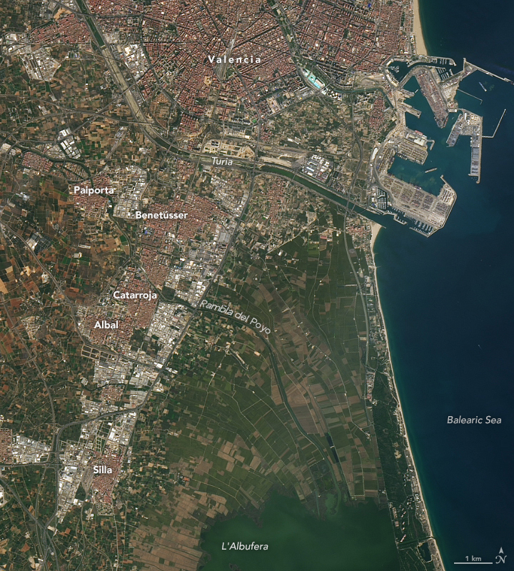
The OLI (Operational Land Imager) on Landsat 8 captured this image (right) showing widespread flooding of urban and agricultural lands in and around the coastal city of Valencia on October 30. Sediment-laden floodwaters also filled the channel of the Turia river, which empties into the Balearic Sea (part of the Mediterranean), and the L’Albufera coastal wetlands south of the city. For comparison, the image on the left, also acquired by Landsat 8, shows the same area in late October 2022. (More recent Landsat scenes of the region were cloud-covered or otherwise unfit for an image comparison.)
The rains came from a high-altitude low-pressure weather system that became isolated from the jet stream, according to AEMET. These storm systems are known locally by the Spanish acronym DANA or more generally as cut-off lows. They occur where cold fronts encounter warm, humid air masses, such as over the Mediterranean Sea. The storms can remain relatively stationary before dissipating, amplifying their flooding potential.
News outlets reported on October 30 that around 100 people—including at least 40 in the town of Paiporta—died in the flooding, and more remained missing. Infrastructure such as roads, bridges, and rail lines sustained damage, and photos show displaced vehicles and debris filling city streets. A military emergency unit deployed more than 1,100 personnel to support rescue operations in the region.
Source:
NASA. (2024, November 1). Valencia Floods. Earth Observatory.