Gepubliceerd op 12 juli 2022
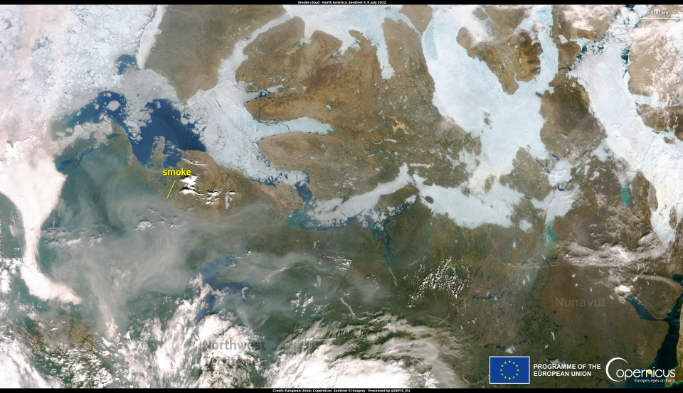
The numerous wildfires ravaging North America are severely deteriorating air quality in the Arctic. In fact, as well as the destruction and risk to life and property, the smoke generated by fires poses a serious risk to health, nearby and far from the source, because of pollutants carried by the wind over hundreds or thousands of kilometres.
On 9 July 2022, one of the Copernicus Sentinel-3 satellites acquired this image, showing the smoke cloud generated by the wildfires engulfing the skies of the Northwestern Territories and Nunavut in Canada.
Complementing Copernicus satellite data, the Copernicus Atmosphere Monitoring Service (CAMS) monitors and forecasts air quality on a global scale by assessing the concentration of air pollutants and modelling their transport and dispersion, as well as providing fire radiative power data.
