Gepubliceerd op 19 mei 2022
A new baseline land cover product
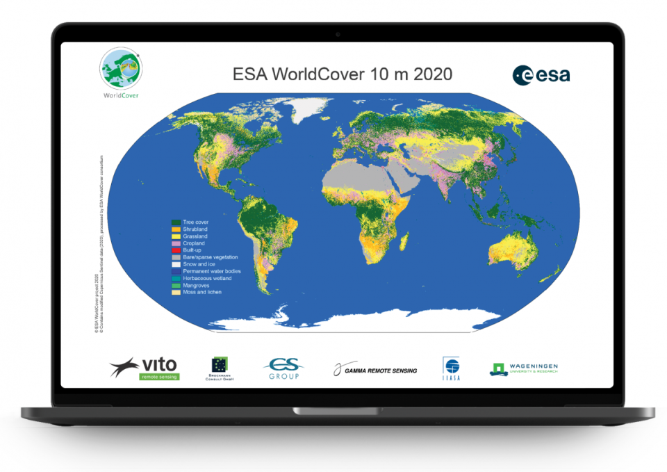
With an ever-changing environment the need for accurate, timely and high-resolution information on land cover and land use, and its changes has increased tremendously over the past years. For this purpose, the European Space Agency (ESA) initiated the WorldCover project. In October 2021 the WorldCover consortium released a brand new and freely accessible global land cover map at 10 m resolution for 2020, based on both Sentinel-1 and Sentinel-2 data with 11 land cover classes and an externally validated overall accuracy of 74.4%.
A global map at 10 m resolution
The goal of ESA’s WorldCover project was clear: to develop a new global land cover map at 10 m resolution in less than 2 years to provide valuable information for many applications such as biodiversity, food security, carbon assessment and climate modelling.
Until now, high resolution, regional or continental land cover maps were solely based on optical data (e.g. Sentinel-2 or Landsat data). However, with both Sentinel-1 and Sentinel-2 at full capacity, WorldCover provided the ideal base to explore the synergetic use of Sentinel-1 and Sentinel-2 at global scale for land cover mapping. By combining these data we were able to deliver the land cover map almost in real time, a major step forward for science and services!