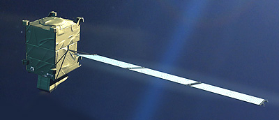
Planned for launch by 2022, the Fluorescence Explorer – FLEX – satellite will detect and measure the light emitted by plants as they convert sunlight and the atmosphere’s carbon dioxide into energy. While this photosynthetic activity is invisible to the naked eye, the instrument will observe the fluorescence of vegetation, yielding important information about plant health.
Information about the health and stress of the planet’s vegetation is important as the growing global population places increasing demands on the production of food and animal feed.
In addition, FLEX will improve our understanding of the way carbon moves between plants and the atmosphere and how photosynthesis affects the carbon and water cycles.
More information: Flex - Report for mission selection - An Earth Explorer to observe vegetation fluorescence

Satellite characteristics
Launch Date - End 1640991600 -
Status Planned
Orbit type Sun-synchronous
Altitude 815
Equatorial crossing time 10:00:00
Satellite family: Earth Explorers
The biggest environmental issue we face is global change, which encompasses not only climate change but also the large-scale impact that a growing global population and continued economic growth are having on the environment.
Earth Explorers provide an important contribution to the global endeavour to further our understanding of Earth. Earth Explorer missions form the science and research element of ESA's Living Planet Programme and focus on the atmosphere, biosphere, hydrosphere, cryosphere and Earth's interior.
However, the emphasis is also on learning more about the interactions between these components and the impact that human activity is having on natural Earth processes.
Earth Explorer missions are divided into two categories: 'core' and 'opportunity'.
Core missions respond directly to specific areas of public concern and are selected through widespread consultation with the science community. Opportunity missions are smaller, low-cost satellites that are relatively quick to implement to address areas of immediate environmental concern.
The user-driven approach is fundamental for both type of mission. The process of mission selection has given the Earth science community an efficient tool for advancing the understanding of the Earth system. The science questions addressed also form the basis for development of new applications of Earth observation.
To date, there have been four core missions and four opportunity missions selected for implementation.
Core missions
- GOCE: the Gravity field and steady-state Ocean Circulation Explorer was launched on 17 March 2009 and ended on 11 November 2013. GOCE provided high spatial resolution gravity-gradient data to improve global and regional models of Earth's gravity field and geoid.
- Aeolus: the prime aim of the Atmospheric Dynamics Mission is to demonstrate measurements of vertical wind profiles from space. The mission employs a high-performance Doppler wind lidar based on direct-detection interferometric techniques. ADM-Aeolus was launched on 22 August 2018.
- EarthCARE: Earth Clouds Aerosols and Radiation Explorer will improve the representation and understanding of Earth's radiative balance in climate and numerical forecast models.
- Biomass: The Biomass mission will provide crucial information about the state of our forests and how they are changing. Carrying the first P-band synthetic aperture radar in space, Biomass will provide measurements to determine the amount of biomass and carbon stored in forests, thereby improving our understanding of the carbon cycle.
Opportunity missions
- SMOS: the Soil Moisture and Ocean Salinity mission, launched on 2 November 2009, is exploiting an innovative two-dimensional interferometer to acquire brightness temperature observations at L-band (1.4 GHz). These observations translate into information on the moisture held in soil and salinity in the surface layers of the oceans, which are needed to further our understanding of Earth's water cycle.
- CryoSat: CryoSat, launched on 8 April 2010, is measuring fluctuations in the thickness of ice on both land and sea determine how Earth's ice is changing. This information is leading to a better understanding of the relationship between ice and global climate. CryoSat carries an innovative SAR/interferometric radar altimeter.
- Swarm: Swarm, launched on 22 November 2013, is providing the best-ever survey of the geomagnetic field and its temporal evolution. The geomagnetic models resulting from the mission will provide new insights into Earth’s interior. This information will lead to a better understanding of atmospheric processes, and also have practical applications in areas such as space weather and radiation hazards.
- FLEX: the Fluorescence Explorer will map vegetation fluorescence to quantify photosynthetic activity. This information will improve our understanding of the way carbon moves between plants and the atmosphere and how photosynthesis affects the carbon and water cycles. It will also lead to better insight into plant health and stress.
Sensor characteristics
| Sensor name | FLORIS (FLuORescence Imaging Spectrometer) |
|---|---|
| Sensor short description | |
| Sensor type | Imaging radiometer (Vis/IR) |
| Resolution class | Low (300 m - 1 km) |
| Swath width (at nadir) | 150 km |