
Satellite characteristics
Launch Date - End 278031600 - 775692000
Status Decommissioned
Orbit type sun-synchronous
Satellite family: Nimbus
Nimbus is a NASA meteorological research-and-development satellite program (parallel to the operational TIROS program) which started in 1963 with the prime objective to test new instrument concepts (introduction of sensor technology), a secondary objective was to provide atmospheric data for improved weather forecasts. Eventually, the series grew more into a major Earth sciences program (study of oceans, land surfaces and atmosphere) with the availability of better sensing instrumentation. The ERTS (Earth Resources Technology Satellite, later renamed to Landsat-1) program, developed in the early 1970s, is a direct descendent of the Nimbus program.Sensor characteristics
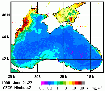
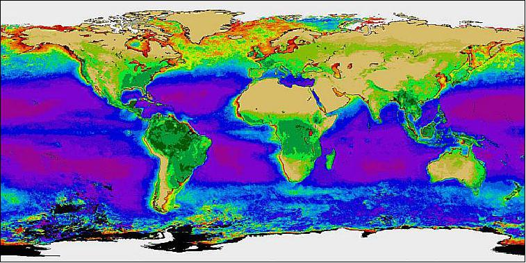
| Sensor name | CZCS (Coastal Zone Color Scanner) |
|---|---|
| Sensor short description | |
| Sensor type | Imaging radiometer (Vis/IR) |
| Resolution class | Low (300 m - 1 km) |
| Swath width (at nadir) | 1566 km |
| Sensor name | ERB (Earth Radiation Budget) |
|---|---|
| Sensor short description | |
| Sensor type | Earth radiation budget radiometer |
| Resolution class | Very Low (> 1 km) |
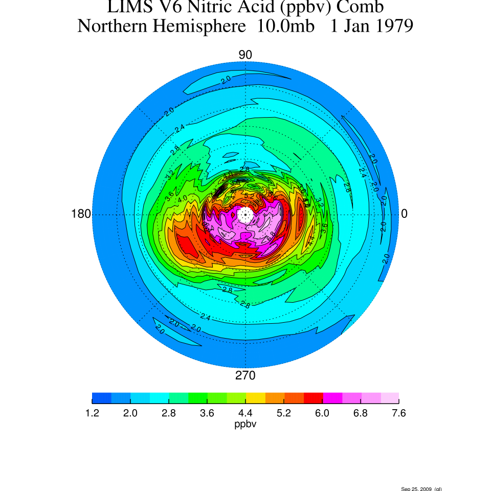
| Sensor name | LIMS (Limb Infrared Monitor of the Stratosphere) |
|---|---|
| Sensor short description | |
| Sensor type | Atmospheric instrument |
| Resolution class | Very Low (> 1 km) |
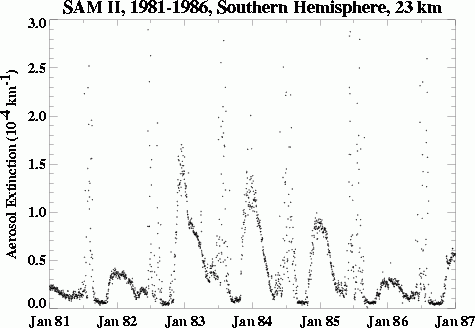
| Sensor name | SAM-II (Stratospheric Aerosol Measurement II) |
|---|---|
| Sensor short description | |
| Sensor type | Atmospheric instrument |
| Resolution class | Very Low (> 1 km) |
| Sensor name | SAMS (Stratospheric and Mesospheric Sounder) |
|---|---|
| Sensor short description | |
| Sensor type | Atmospheric instrument |
| Resolution class | Very Low (> 1 km) |
| Sensor name | SBUV/TOMS (Solar Backscatter Ultraviolet/Total Ozone Mapping Spectrometer) |
|---|---|
| Sensor short description | |
| Sensor type | Atmospheric instrument |
| Resolution class | Very Low (> 1 km) |
| Sensor name | SMMR (Scanning Multichannel Microwave Radiometer) |
|---|---|
| Sensor short description | SMMR is a multispectral, dual-polarization microwave radiometer observing in K-band (~0.75cm to ~2.5cm), X-band (~2.5cm to ~4.0cm) and C-band (~4.0cm to ~8.0cm). |
| Sensor type | Imaging radiometer (passive microwave) |
| Resolution class | Very Low (> 1 km) |
| Spatial resolution | 22 km to 120 km |
| Spectral bandwidth | 6.6 GHZ (45.4 mm) 10.7 GHz (28 mm) 18.0 GHz (16.6 mm) 21.0 GHz (14.2 mm) 37.0 GHz (8.1 mm) |
| Swath width (at nadir) | 600 km |
| Max look angle | 42 ° |
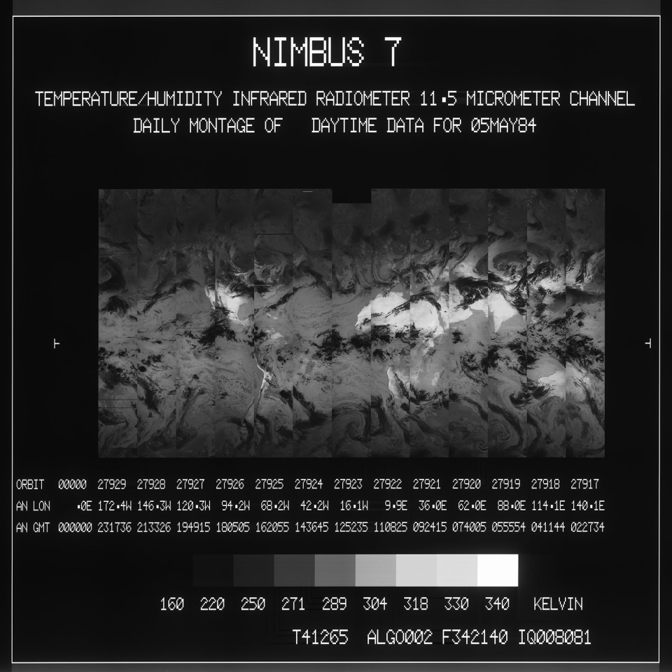
| Sensor name | THIR (Temperature Humidity Infrared Radiometer) |
|---|---|
| Sensor short description | |
| Sensor type | Atmospheric instrument |
| Resolution class | Very Low (> 1 km) |