Context and objectives
The mapping of Suspended Particulate Matter (SPM) from river plumes is relevant for a number of coastal water applications, including assessment of sediment transport (optimizing dredging/dumping operations, understanding bathymetric/coastline changes), water quality monitoring (turbidity), determination of euphotic depth for primary production, etc. Existing methods developed previously at RBINS for atmospheric correction and SPM estimation perform well in turbid waters, but are severely limited in extremely turbid waters.
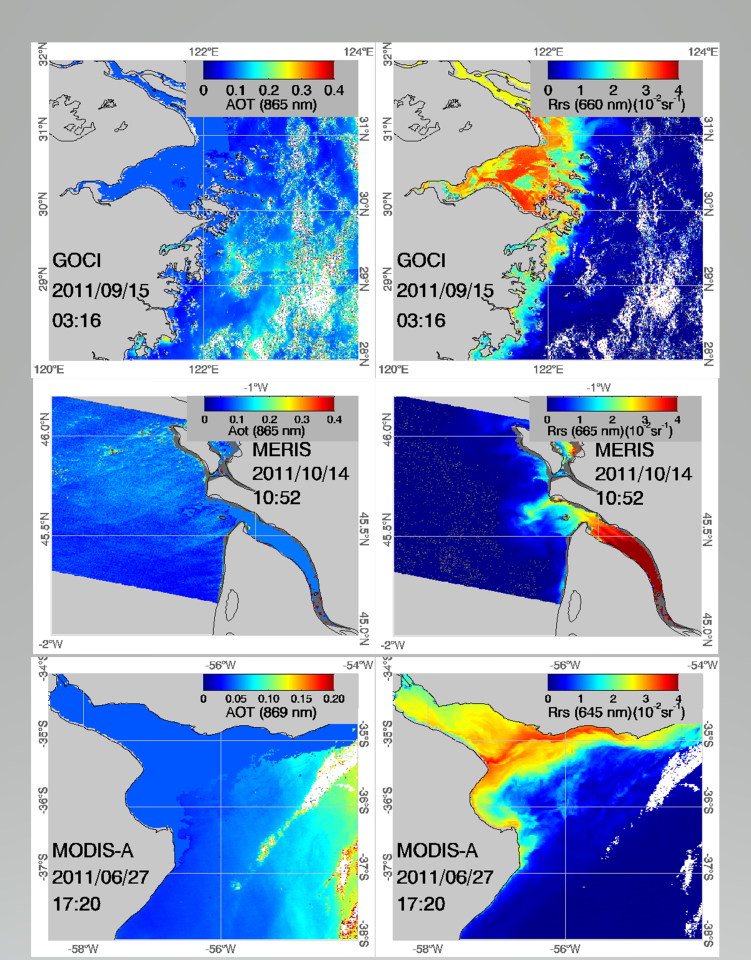
The general objective of the BEL-GOYA project was to develop, compare and validate algorithms for atmospheric correction and suspended particulate matter (SPM) retrieval from ocean colour satellite data of extremely turbid river plumes and estuaries. The particular focus was on the Gironde, Yangtze (Changjiang) and Río de la Plata river estuaries/plumes.
Project outcome
The BEL-GOYA project produced the following results:
1. The semi-analytical single band algorithms of (Nechad et al., 2010) and (Shen et al., 2010) were found to be the most suitable for use with NIR bands of any ocean colour sensor lacking SWIR bands. Band ratio algorithms are more regional than the single NIR-band algorithms, since they use the visible bands and are more sensitive to variability of Specific Inherent Optical Properties.
2. The performances of existing near infrared based atmospheric correction algorithms: NIR-V (“variable” aerosol model estimated pixel-by-pixel), the neural network based MEGS8.1 for MERIS, and GOCI GDPS1.2 were evaluated and compared to those of the NIR-FF algorithm in extremely turbid waters. The NIR-FF algorithm, which assumes spatial uniformity of both aerosol type and concentration over a limited region, was found to perform best in extremely turbid waters.
3. New algorithms have been developed and tested for the classification of clear, moderately turbid and extremely turbid water pixels and for the detection of cloudy pixels with better performance in extremely turbid waters.
4. Recommendations are made for optimal band sets on future ocean colour sensors taking account of the needs of optimal atmospheric correction and SPM retrieval in extremely turbid waters.
| Project leader(s): | IRSNB/KBIN - Directorate Natural Environment - Ecosystems data processing and modelling | |
| Location: |
Algemeen |
|
| Related presentations: | ||
| Related publications: | ||
| Website: | http://www.obs-vlfr.fr/LOV/OMT/projects.htm#goya | |
