Context and objectives
In the design and development of remote sensors, a trade-off exists between SNR, spatial and spectral resolutions due to physical limitations and data-transfer requirements. This trade-off still hampers the use of remote sensing data for many applications. The Hyperion sensor currently offers the highest spectral resolution available from space. The spatial resolution of only 30 meters however restricts a proper use of the inherent potential of these data to easily distinct different objects. On the other hand, sensors such as Quickbird and WorldView-1&2 are able to offer very high resolution imagery, but this is at the expense of their spectral resolution: panchromatic at sub-meter spatial resolution, and 4 to 8 (Worldview2) spectral bands with approximately 2.5m spatial resolution. Although airborne acquisitions do allow capturing hyperspectral image data at a high spatial resolution (1-7 m) (e.g., AHS, APEX), their spatial coverage is limited. Moreover, many applications, such as detailed land cover mapping, studies focusing on vegetation dynamics and vegetation status assessment require even higher, i.e., cm level applications.
Project outcome
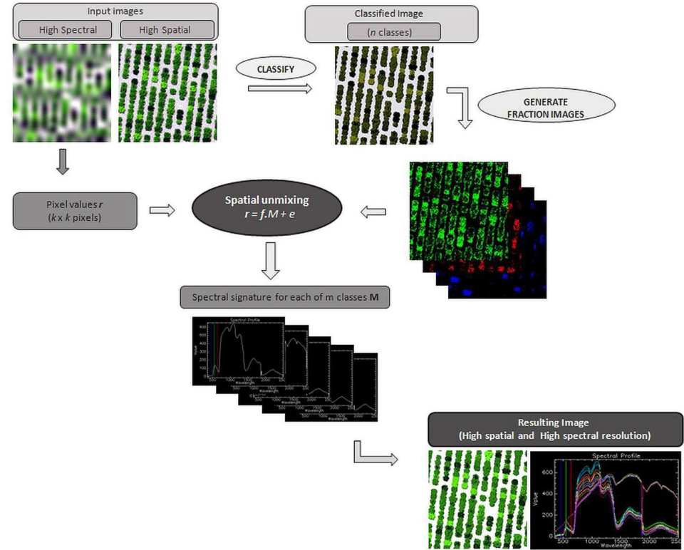
The integration of spatial information from a hyperspatial image into a hyperspectral image, while preserving the spectral information of the latter. The results were twofold:
- An improvement of the accuracy of biophysical parameter estimation through narrow band vegetation indices in fruit orchards in order to better steer the orchard management, and
- Classification maps of higher spatial resolution.
| Project leader(s): | VITO - Remote Sensing - Teledetectie en aardobservatieprocessen | |||
| Belgian partner(s) |
|
|||
| Location: |
Country:
|
|||
| Related presentations: | ||||
| Related publications: | ||||
| Website: | ||||