For a direct access to available images and software, go and visit our section Data & Tools.
Initiatives supported by BELSPO
Data facility
CVB (Centre for Image processing) is the Belgian multi-sensor processing, distributing and archiving facility. Hosted at Mol (VITO), it was originally launched in 1998 by BELSPO to process, distribute and archive the satellite data from the SPOT Vegetation programme. Throughout the years the Centre evolved into an all-round data processing and distribution facility of terrestrial vegetation data with as main focus:
- operational exploitation of ESA’s PROBA-V mission and production of PROBA-V derived bio-physical parameters for the Copernicus Global Land Service;
- reprocessing, archiving and distribution of all SPOT VEGETATION data;
- operations of ESA’s hyperspectral airborne APEX instrument.
From its distribution portal, you can download data from the SPOT VEGETATION, PROBA-V, APEX sensors in addition to data from METOP-AVHRR and MERIS.
Since 2017, the centre also hosts Terrascope, the Belgian Copernicus Collaborative ground Segment. Terrascope is the platform for all Belgian citizens to search, visualize, analyze and share Earth Observation data from Sentinel missions.
Federal & Regional Geoportals
The federal state and the 3 regions of the country offer citizens a geographical information portal.

Geoportal of the federal state of Belgium
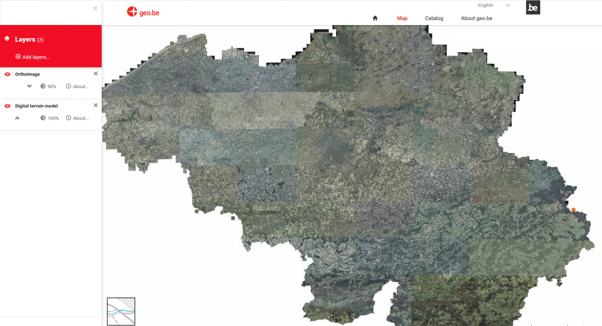
Geo.be is the gateway to the geographic platform of the federal government and is available in four languages: Dutch, French, German and English. The aim of this portal is to facilitate the access to the geographic data owned by the federal institutions and to the corresponding web services. This portal allows you to:
- look up and consult the data and the web services which are available in the catalogue;
- view the available data and web services in a cartographic browser;
- gain access to the URLs of the WMS, WTMS, ATOM feed and WFS web services.
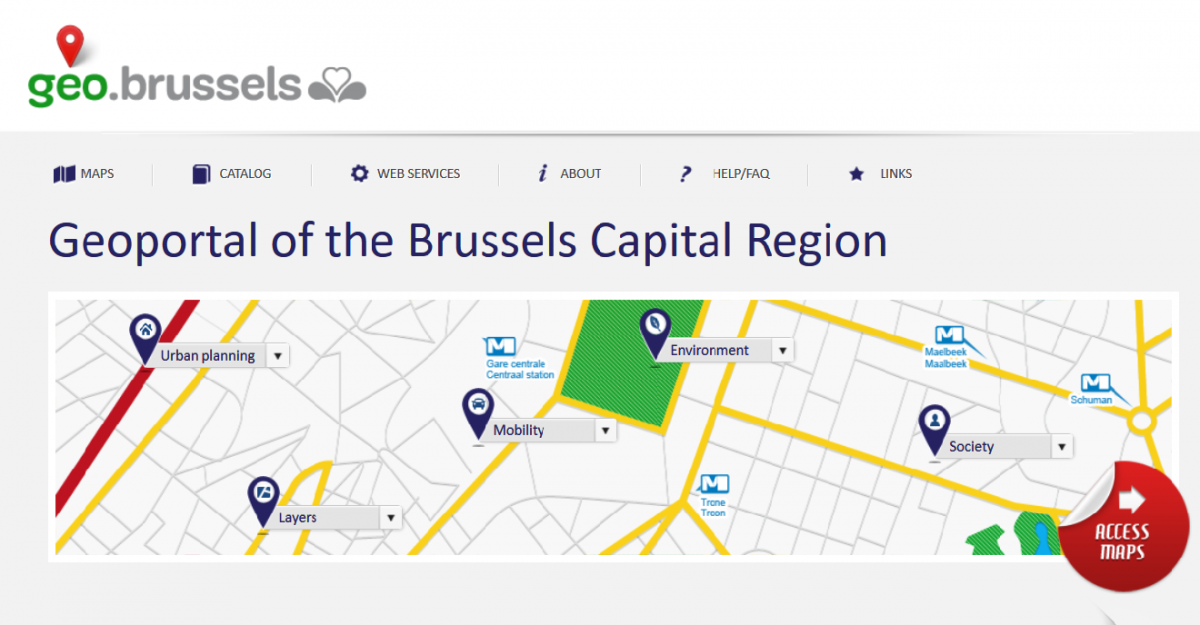
Geoportal of the Brussels Capital Region
The geo.brussels portal contains the official geographical data of all the Brussels institutions and administrations, which include Brussels Environment, Brussels Mobility, Brussels Urban Development, Brussels Institute for Statistics and Analysis (BISA), STIB and the Brussels Regional Informatics Centre (BRIC).
It offers free access to baseline geographical information over the entire region, be that regarding the environment, mobility, urban development, land planning, demography or quality of life.
In addition to consulting the thematic maps available in the catalogue, you can:
- create your own customised maps;
- save them on the website so you can consult them later or share them (upon subscription to the website);
- use the data in your own information systems via the online WMS and WFS services.
You can use the portal to access UrbIS Online and have an interactive view of the UrbIS template and the orthophoto maps that cover the territory of the Brussels Region for 2012, 2014, 2015, 2016 and 2017. The orthophoto maps are the result of correcting aerial photographs to eliminate deformations caused by the relief and perspective. They are metric resolution photos that make it possible to measures distances.
To supplement the data available on geo.brussels, Brussels Environment is providing access to data on its own themes, such as green spaces, biodiversity and flood risk areas.
These different portals have been designed to implement the European INSPIRE (INfrastructure for SPatial InfoRmation in the European community) Directive, whose goal is to facilitate access to and the exchange, sharing and use of geographical information.
Geoportal of Flanders
Geopunt is the portal where the Flemish Government collects all its spatial data and distributes it to the public. From parcels over roads to rivers; everything is displayed on a single map. The same map can be complemented with aerial imagery, historical data, flood maps, spatial plans etc
Civilians, consultancy firms and GIS coordinators can each use the data the way they prefer. The data can be consulted through the website directly, embedded within another website displaying only the layers you’re interested in, and using open-source plugins, all of these data can even be used in a GIS software package.
Geopunt is the Flemish node in a European geographical data infrastructure complying with the demands of the INSPIRE guideline.
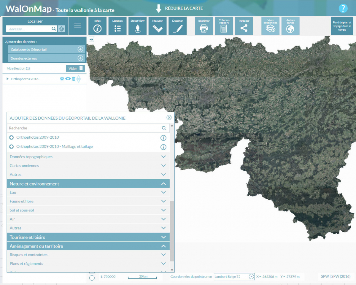
Geoportal of Wallonia
Introduced by the Wallonia Public Service, the Wallonia Geoportal is the gateway to Walloon geographic information and geomatics and a window on European geographic information.
The Geoportal provides citizens and workers in the public or private sectors with access to a range of data and geographical tools covering the Walloon region.
In particular, the Geoportal provides the following Earth observation data:
- orthophotos acquired through annual aerial campaigns;
- LIDAR data acquired in 2013-2014;
- very high-resolution images from the Pléiades satellite acquired in 2013 and covering the whole of Belgium.
Geoportal also offers direct access to the mapping application, WalOnMap which can be used to view an interactive map of the geographic data relating to the Walloon region. This reliable, quality information is made available to all by the public authorities.
The Wallonia Public Service also provides another tool called APIGeoviewer. This is a programming toolbox offering all the components needed to create a dynamic map on the internet.
Finally, in 2016, the Walloon Region set up a working group on Earth observation, the COWAL WG. The main aim of this group is to facilitate the use of remote sensing and Earth observation tools within the administration.
Other acces to COPERNICUS data
Copernicus is the European Earth Observation Programme. It is served by a fleet of observation satellites, the Sentinel family, as well as a global network of sensors to produce images of the Earth and ensure the monitoring of the Earth’s land, water and atmosphere in order to answer to Europe's needs. The vast majority of data provided by the Copernicus Space Infrastructure and Services are made available and accessible to all citizen on a free, full and open access basis.
In addition to the national access point, the Belgian Collaborative Ground Segment, Terrascope (see above), you can also access Copernicus data and information services via EU’s Copernicus DIAS (Data and Information Access Services), a European Commission initiative aimed at facilitating and standardizing access to satellite data, or via the conventional mission data access platforms.