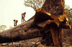
The state of Rondonia in western Brazil is one of the most deforested regions of the Amazon rainforest. The main cause of deforestation is clearing of land for agriculture and livestock.
Although the annual rate of deforestation in Brazil has been sharply declining in recent years, it still amounts to 2.6 million hectares (the size of Luxembourg). On this SPOT VEGETATION image, one can clearly see the linear cuts in light brown contrasting with the green of the forest. The image is composed from the values recorded in the mid-infrared, near infrared and red spectral bands.
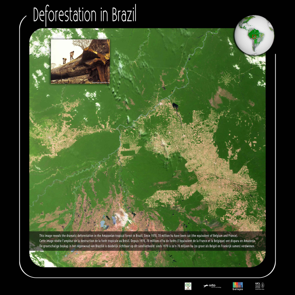
This image reveals the dramatic deforestation in the Amazonian tropical forest in Brazil.
With a surface of 850 million hectares, Brazil is the fifth largest country in the world. The country covers an area more than twice as big as the European Union. Nearly two thirds of this immense territory is occupied by forest, ranking Brazil 2nd in the list of the world's most forest-rich countries, after the Russian Federation.
The largest rainforest at risk
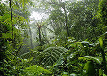
Brazil hosts the largest area of rainforest in the world. The Amazon rainforest is a primary forest. It is home to 50 % of global biodiversity, 20 million people and 20 % of the freshwater resources of the planet. It is a valuable ecosystem that provides a multitude of ecological, economic and social functions for both the local people and the entire planet.
This ecosystem, one of the richest on Earth, is also one of the most threatened. The Brazilian Amazon has the highest rate of deforestation of the planet. A study based on satellite images by the National Institute for Space Research of Brazil (INPE) found a total loss of 72 million hectares since 1970, or 17% of its total area.
Brazil has lost an average of 2.9 million hectares of forest per year between 1990-2000 and 2.65 million hectares per year between 2000-2010. Deforestation has steadily declined since 2004, due to several factors including regulations and national forest programmes, as well as private and international initiatives.
Why do we destroy the rainforest?
In a country as vast as Brazil, the causes of deforestation are diverse and vary according to the economic, political and social contexts.
For many years, the main reason for deforestation in the Amazon basin was slash and burn agriculture by small farmers. Today, large farmers, especially cattle farmers, seem to be primarily responsible for the conversion of forest to pastures. Large commercial plantations of soybean, oil palm and sugar cane, the development of road networks, hydroelectric infrastructure and logging are also important causes of deforestation.
Satellites to reduce carbon emissions
Climate change is one of the major concerns worldwide. To reduce emissions of greenhouse gases (GHG), the fight against deforestation is an important road to follow.
Deforestation is indeed responsible for 22 % of total global GHG emissions. In Brazil, this number is even higher: deforestation and land conversion are responsible for about 75 % of GHG emissions. Brazil is also the fourth largest emitter of greenhouse gases worldwide.
To protect the world's forests, the tropical forests in particular, the UN launched the REDD (Reducing Emissions from Deforestation and forest Degradation) programme. Its aim is to reduce deforestation by financially rewarding developing countries that undertake measures to protect their forests.
To be effective, a forest protection programme needs fast, accurate, objective and reliable monitoring. Regularly updated cartographic maps are undoubtedly necessary to measure the effects of national policies.
Satellites are essential tools for this kind of monitoring. With high-resolution images acquired regularly, changes in forest cover and land use are unveiled. These images are used to identify areas of illegal deforestation or the development of new access roads. The authorities can then monitor the compliance with forest management plans and prevent deforestation.
This page was written in 2009, as additional information to the poster series "10 years of Imaging the Earth"