Context and objectives
![]()
![]()
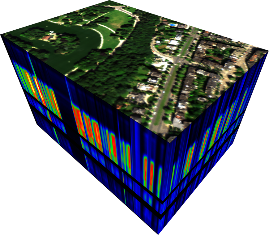
Remote sensing big data is now being enriched with airborne and spaceborne imaging spectroscopy, and this presents interesting opportunities for the monitoring of urban areas. Yet image processing remains fraught by limited access to urban spectral reference data and the tools required to manage them. Dynamic urban changes, the increasing availability of different remote sensing data, time-consuming processes to obtain training data, and the particularly high within-class variability of urban materials lead to many requests for a generically usable urban spectral library to support different urban mapping approaches.
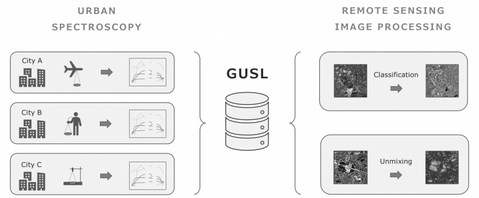
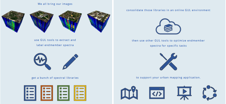
The GENLIB research project proposes the concept of a Generic Urban Spectral Library (GUSL) to address these challenges and help streamline urban mapping. We define a GUSL as a multi-source collection of richly labelled and tightly structured spectral libraries that cover any part or aspect of the physical urban environment. Each spectral library in the GUSL may cover one or more cities, time periods, band set definitions and spectrum class labels. Reference spectra can be generated by imaging, in-situ or laboratory spectroscopic measurements, or even a combination thereof.
The main objective of the GENLIB project was the development of a conceptual framework for a Generic Urban Spectral Library (GUSL). This includes the generation of a respective data model and metadata scheme as well as a set of tools to enable the usability of the GUSL in terms of multi-site, -source, and -scale urban mapping.
Project outcome
Scientific results
The GUSL concept developed and implemented in the project was tested in the context of different GUSL application scenarios. An experimental GUSL was built, containing almost 9000 spectra from eight source libraries, covering 10 cities in Belgium, Germany, UK, USA. The GUSL was used in four use case experiments demonstrating the application of the GUSL for
- image-based library building
- GUSL optimalization
- airborne hyperspectral classification
- spaceborne hyperspectral unmixing.
The first experiment on image-based library building demonstrates how the GUSL can help in producing spectral libraries from high-resolution imagery, which is a common first step in urban mapping workflows.
The second experiment on GUSL optimalization showed the positive effects of library pruning on the GUSL in terms of reducing redundancy and spectral ambiguity.
The third experiment focused on airborne hyperspectral classification and demonstrated the potential of the GUSL for mapping urban sites in the absence of local reference spectra.
In the fourth and final experiment we investigated if the GUSL can be leveraged to move beyond the typical VIS unmixing by targeting a thematically enhanced mixing framework with 6 generalized material classes.
Results showed that the mapping approach proposed did manage to correctly distinguish high vs. low fraction pixels for each class, yet for some classes erroneous residual fractions did occur, particularly in the lower fraction range requiring a further optimization of the synthetic mixing process and/or library pruning workflow.
Societal (including environmental) relevance
The GUSL is envisioned to be distributed through the openly accessible SPECCHIO data system and grow dynamically with contributions of new spectral libraries from a benefiting user community.
Products and services
- Metadata scheme for organizing and documenting GUSL reference spectra
- Generic labelling scheme for flagging and structuring GUSL reference spectra
- (Internal) data model implementation in SPECCHIO
- GUSL-Tools for library building, mapping, and access
Potential users
(Urban) remote sensing community with interests in urban (material) mapping.
Outreach
Spectral libraries to better interpret cities
Spectrale bibliotheken om steden beter te kunnen lezen
Des bibilothèques spectrales pour mieux lire les villes
| Project leader(s): | VUB - Cartography and GIS | |||
| Belgian partner(s) |
|
|||
| Location: |
Continent:
Region:
|
|||
| Related presentations: | ||||
| Website: | https://www.genlib.info/ | |||