Context and objectives
![]()
![]()
The overall objective of the EODAHR project is to explore the effect of Level 1 backscatter data assimilation in hydrological and land surface models. The research hypothesis is that assimilation of microwave-based satellite data related to soil moisture and vegetation, allows the reduction of errors in the estimation of soil moisture states and eventually the enhancement of the accuracy of streamflow predictions.
The use of Level 1 data requires the implementation of dedicated observation operators (also referred to as forward operators) into the data assimilation scheme, in order to link the observations with the prognostic state variables. We propose to optimally utilize Level 1 C-band backscatter data from ESA’s Advanced Scatterometer (ASCAT) and Sentinel-1 to simultaneously update soil moisture and vegetation estimations in hydrological simulations.
Project outcome
Scientific results
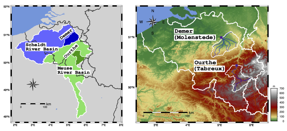
Over multi-year time periods, we observe an improvement in the streamflow estimation for the Ourthe catchment only, while the change for the Demer catchment is marginal for both the SCHEME and the Noah-MP models. An evaluation of surface soil moisture from Noah-MP against independent soil moisture retrievals indicates that the Sentinel-1 backscatter data assimilation improved surface soil moisture estimates. Our results further indicate that the Ourthe catchment has a much stronger soil moisture-runoff coupling, which may explain that, naturally, less impact of an improved soil moisture is to be expected for the Demer catchment. The positive results for the Ourthe catchment suggest that there is potential to improve streamflow through assimilation of Level-1 backscatter data even for forested catchments.
Societal (including environmental) relevance
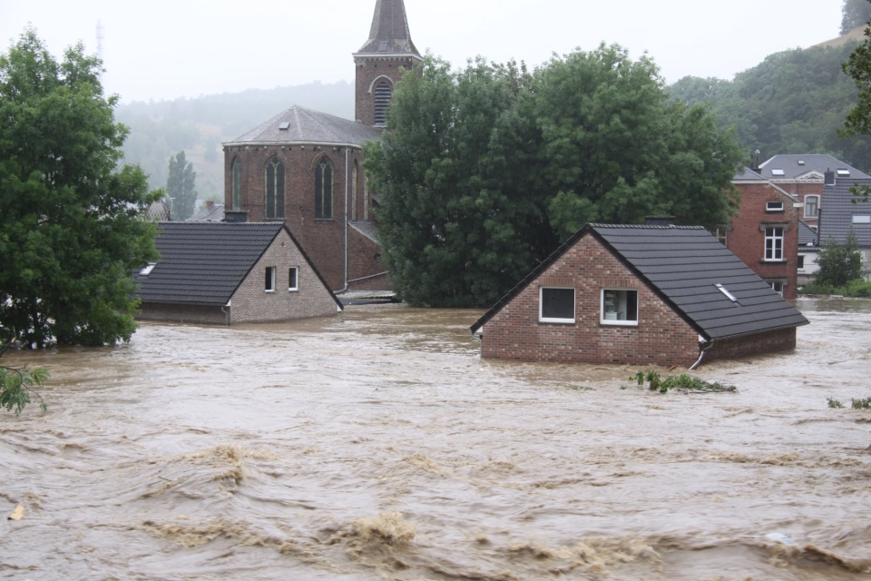
This is important preparatory work for operational centers that are responsible for producing the most accurate flood forecasts for the society. Our results provide new insights into how and where streamflow forecasting could benefit from high spatial resolution Sentinel-1 radar backscatter observations.
Products and services
Extension to the NASA Land Information System (LIS) to accomodate for Sentinel-1 backscatter data assimilation, open source on GitHub. Pull Request under review at NASA: https://github.com/NASA-LIS/LISF/pull/1208/.
Potential users
This study is primarily addressed to researchers working in remote sensing data use in hydrology. It could potentially be used by local authorities in a hydrological forecasting context to improve early warnings.
Outreach
EODAHR: better flood risk forecasting with radar
EODAHR: betere overstromingsvoorspellingen dankzij radar
EODAHR: mieux prévoir les risques d'inondation grâce au radar
| Project leader(s): | IRM/KMI - Royal Meteorological Institute of Belgium | |||
| Belgian partner(s) |
|
|||
| Location: |
Country:
Region:
|
|||
| Related presentations: | ||||
| Website: | http://eo-dahr.meteo.be/meteo/view/en/43300276-Home.html | |||