Published on 7 September 2023
Despite its potential benefits, the applications of “bistatic” SAR in agriculture and hydrology haven't been explored much. One reason is the lack of experimental data combining bistatic SAR with in-situ measurements of soil and vegetation.
Recognizing this gap, the Belgian Science Policy Office (BELSPO) and the European Space Agency (ESA) collaborated on the BELSAR project. This project had three phases: data collection (BELSAR-Campaign, 2016-2018), scientific analysis (BELSAR-Science, 2019-2022), and sharing findings (BELSAR-Publication, 2022-2023). The project collected a unique dataset containing both mono- and bistatic fully-polarimetric SAR data in L-band (around 23 cm wavelength) and extensive in-situ measurements of vegetation and soil bio-geophysical variables in maize and winter wheat fields. All these data were acquired in Belgium, over the BELAIR HESBANIA test site, in 2018.
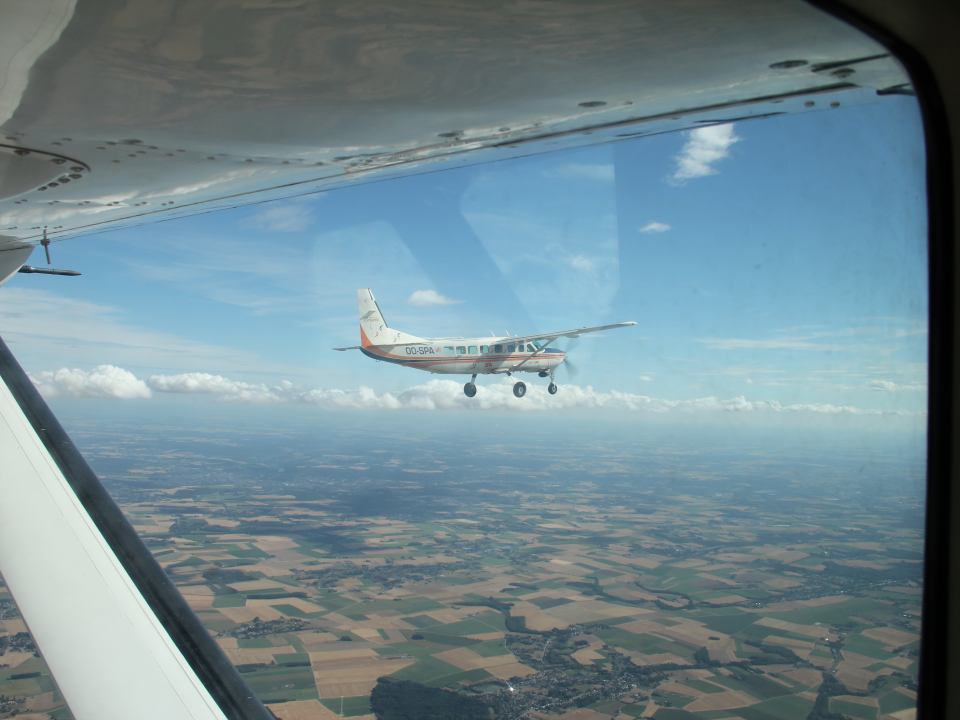
Bistatic airborne SAR system mounted on two airplanes flying in tandem during the BELSAR-Campaign.
The BELSAR-Science project, initiated in 2019, aimed to use this dataset for developing SAR science (advanced SAR processing) and applications in change, hydrology (soil moisture) and agriculture (crop monitoring). Four academic partners—UCLouvain, UGent, the ULiège Space Center and the Royal Military Academy—brought their expertise to the project, alongside private partner MetaSensing B.V., who helped with the airborne campaign.
 |
 |
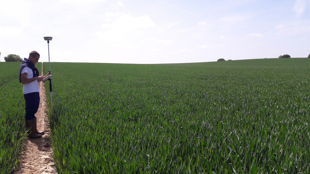
Researcher in a winter wheat field during BELSAR-Campaign. |
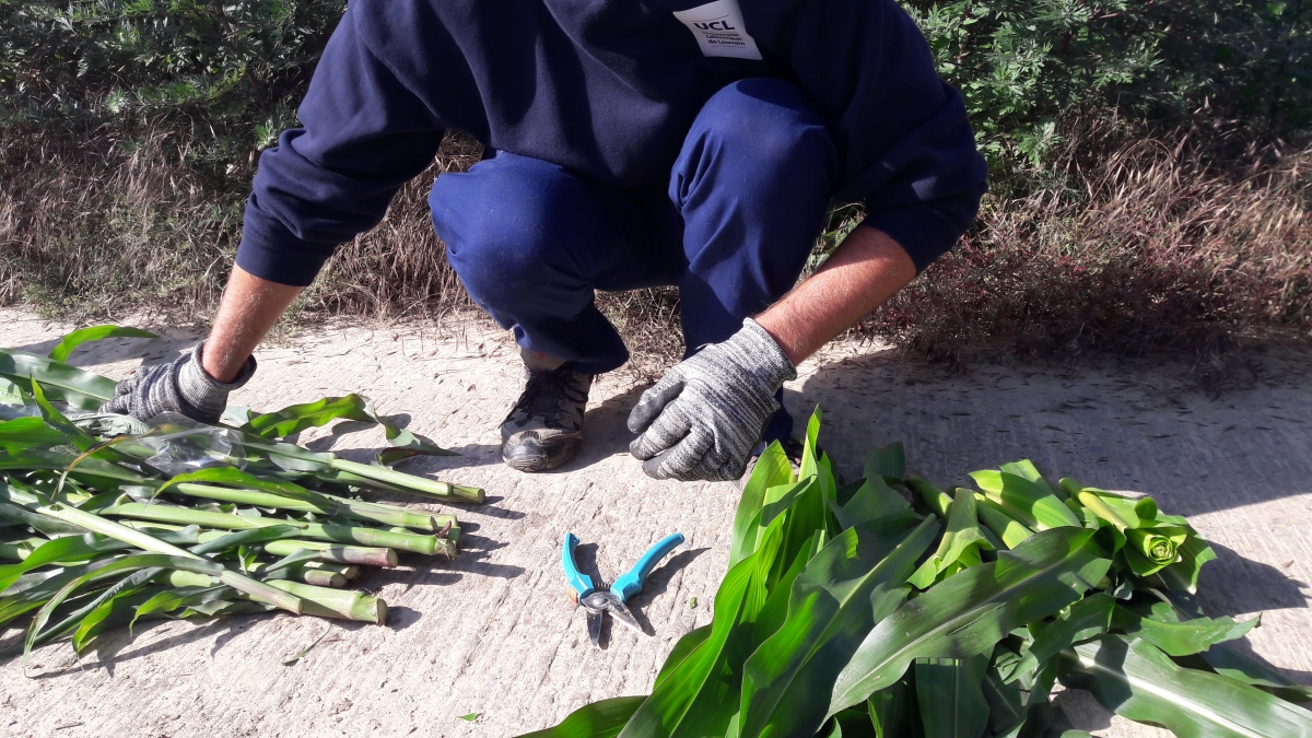
Researcher preparing a vegetation sample for oven drying to determine its dry matter content during BELSAR-Campaign. |
Throughout the BELSAR-Science project, advanced interferometric SAR products were generated to complete this already considerable dataset. Researchers also assessed the potential of the bistatic system used in BELSAR-Campaign and provided recommendations for future satellite remote sensing missions. Additionally, algorithms were developed and tested to estimate soil moisture and the green area index (i.e., the ratio of green leaf and stem area to the area of ground) of crops, two critical indices for crop monitoring and yield forecasting, which could benefit farmers, decision makers and consultants in a timely, reliable, cost-effective manner, regardless of weather conditions.
 |
 |
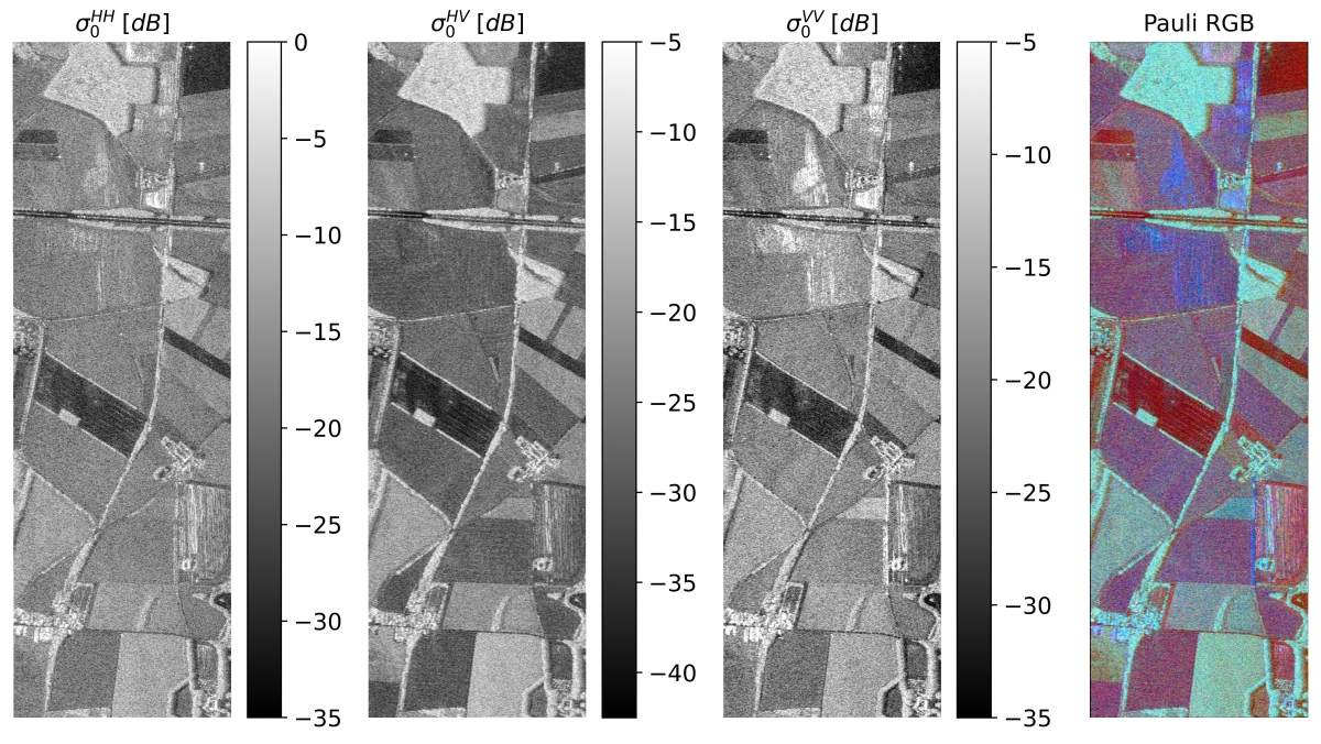
The same scene imaged by the airborne SAR sensor used in the BELSAR-Campaign. The images shows three different polarizations, as well as their Pauli RGB color composite. SAR reacts to surface characteristics such as structure and humidity, enabling us to see the scene differently than with optical systems. The images were acquired on 20 June 2018. |
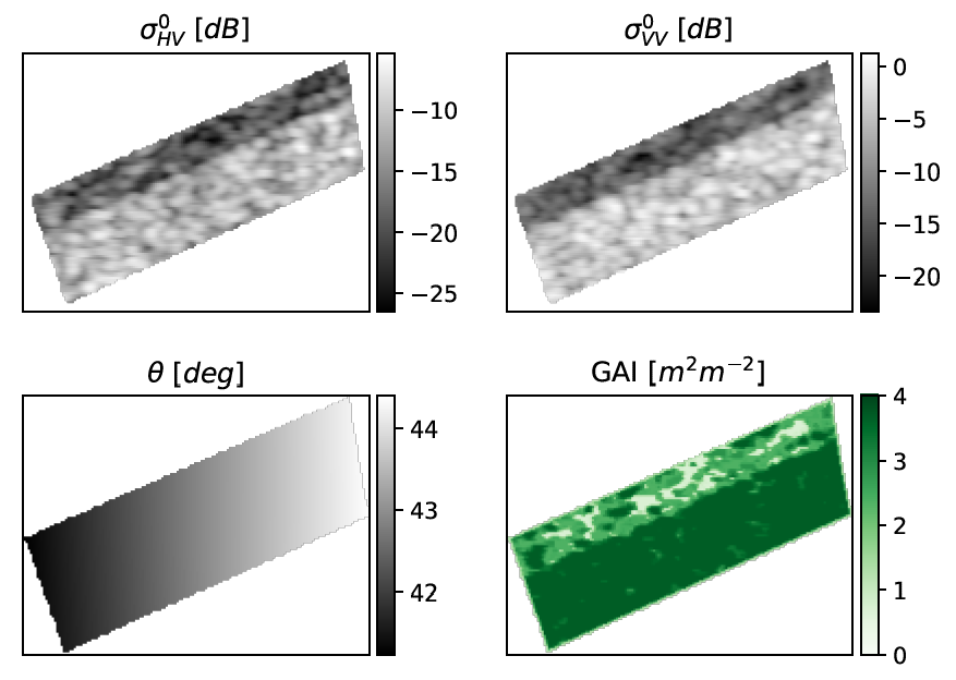
Green Area Index (GAI) map of a partly-harvested maize field, in which in-situ data were collected, acquired on 26 August 2018. The GAI, i.e, the ratio of green leaf and stem area to the area of ground, is used to assess crop development, health and forecast yield. |
To make this wealth of data accessible to the public, the BELSAR team has thoroughly documented it in a data descriptor, currently under review. They've also combined the different sources of data from BELSAR-Campaign, i.e. SAR images, soil and vegetation datasets into a unified, freely-accessible dataset ready for analysis. This dataset promises to continue delivering valuable insights in the future.
The BELSAR-Science team
Université catholique de Louvain (UCLouvain)
|
|
|

Universiteit Gent (UGent)
|
|


Centre Spatial de Liège (CSL) – ULiège