Context and objectives
ECTIC aimed at testing ICEYE products. ICEYE is a Finnish X-band SAR constellation registered by ESA in the Earthnet Third Party Mission (TPM) framework. The scientific questions to answer are: Would ICEYE wide band allow performing sound split band processing and spectral coherence derived measurement? And would this additional information channel combined with intensity lead to an augmented product allowing to increase detectability of scatterers distribution changes. Two applications are targeted:
- height change detection by tracking SAR shadow changes through time series, i.e. lava lake level monitoring at Nyiragongo volcano through SAR shadow measurement, an already operational application that makes use of recurrent Sentinel1 data;
- vessel detection and deforestation detection, by testing split band processing on ICEYE data to generate the so-called spectral coherence layer and combine spectral coherence with intensity image to help in the detection of temporal changes induced by rugosity and scatterers distribution changes.
A side objective is to make ICEYE data compatible with the CIS/MasTerEngine that already handles ERS, JERS, ALOS, EnviSAT, RadarSat, CSK, TerraSAR-X, TanDEM-X, PAZ, Kompsat5, Sentinel1 and SAOCOM data.
Project outcome
Scientific results
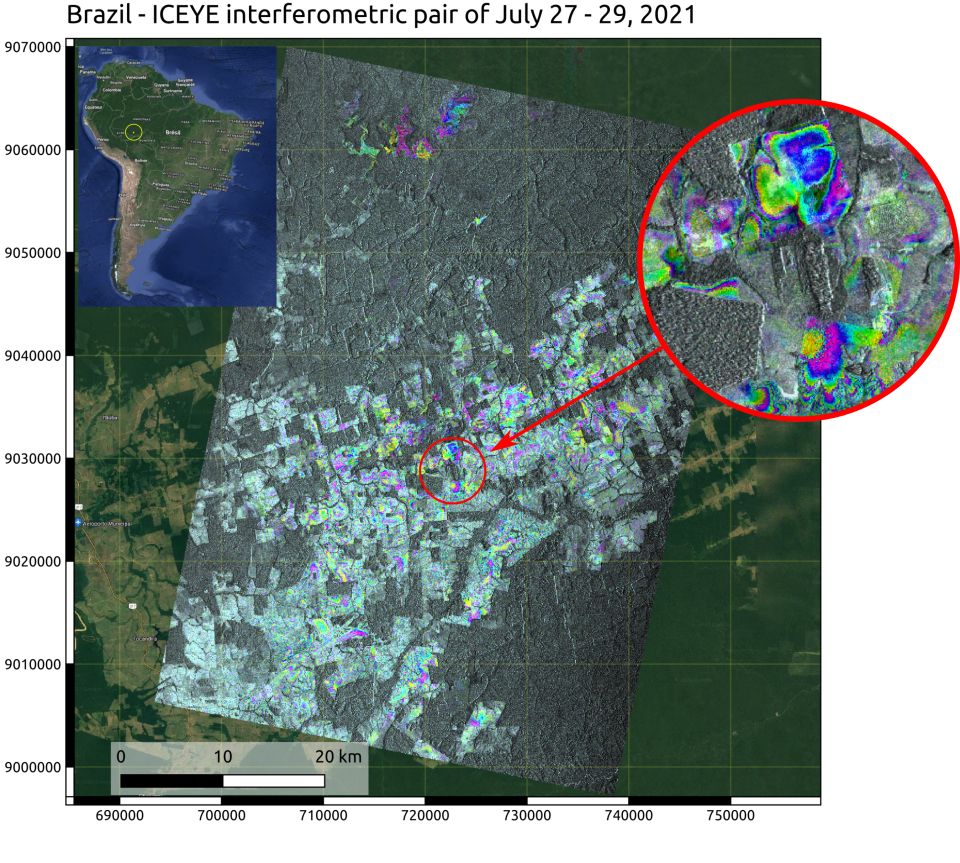
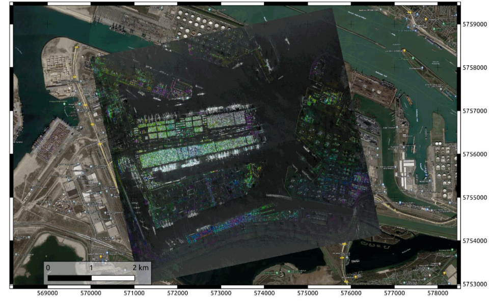
First tests for stripmap and spotlight data reading were successfully done with data made freely available on the ICEYE website. Using a set of 4 images of the Amazonian Forest in Brazil, InSAR products generated by the CIS processor allowed to highlight deforested areas. Test of spotlight acquisitions of the Rotterdam harbour provided geoprojected InSAR products in UTM at ground sampling of 2x2 meters.
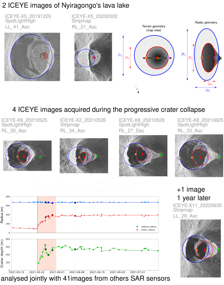
Spotlight data of the Nyiragongo were processed with the MasTer Toolbox for shadow cast management, taking advantage of the sub metric resolution ICEYE data allowing to image geomorphological features with better resolution compared to other sensors (41 images from ALOS2, CSK, Capella, RCM, SAOCOM, S1 and TSX), and the various viewing geometries offered by the constellation. At the time of pre-eruptive images acquisition, the lava lake and crater bottom were both at the level of their neighboring reference surface, hence no shadow were cast and available to measure height. This is consistent with what was observed with the other sensors. During the eruption, the 4 ICEYE images provide crater depths and crater diameter measures consistent with measures obtained with the other sensors. The post eruptive image acquired one year after the eruption clearly shows that the lava lake reappeared and started to rise again, confirming what was observed with other types of data. ICEYE measurements were integrated to existing time series obtained using other sensors.
Regarding spectral coherence measurements, results are less convincing. It was clearly shown that split band processing is correctly working using ICEYE data but expected results in terms of environmental change detection were not achieved. The first stripmap image gives good results in the frame of vessel tracking and shows good contrasts of measured spectral coherence on the area of interest. The second image, while also showing good spectral coherence contrast, shows highly noisy results on the Kivu Lake, hindering any vessel detection. Additionally, this image suffers from an important orbital error leading to erroneous localization after geo-projection, impeding comparison with the first image and so performing
any environmental change detection.
Products and services
IICEYE data reader for handling ICEYE data by the CSL InSAR Suite and the MasTerEngine.
Python software for picking the geomorphological features on amplitude image to be distributed with upcoming paper on the geomorphological changes of Nyiragongo crater associated to the 2021 eruption.
Outreach
ECTIC: Environmental Change tracking using the ICEYE Constellation
ECTIC: Suivi des changements environnementaux à l'aide de la constellation ICEYE
ECTIC: Milieuveranderingen opvolgen met de ICEYE-constellatie
| Project leader(s): | CSL - Centre Spatial de Liège | |||
| International partner(s) |
|
|||
| Location: |
Country:
Region:
|
|||
| Website: | ||||


