Context and objectives
![]()
![]()
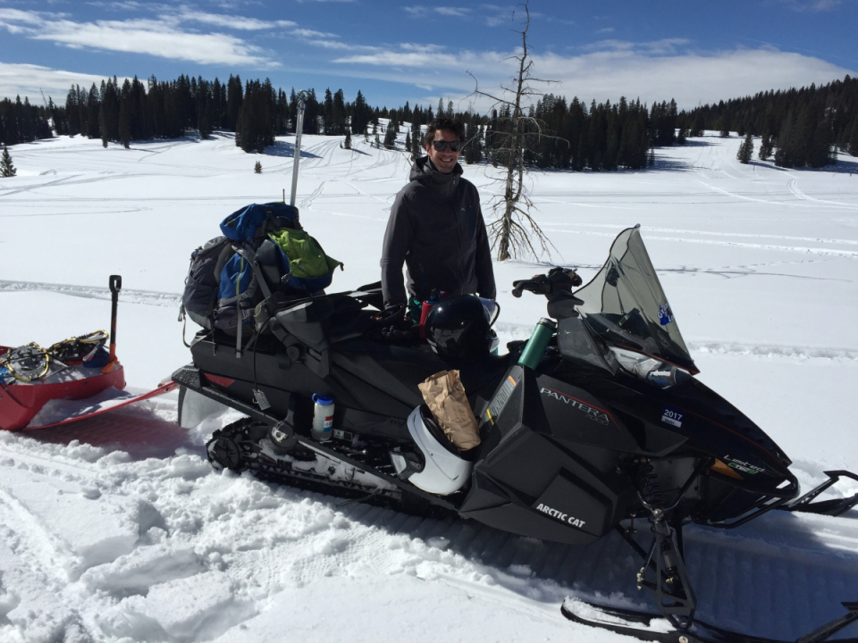
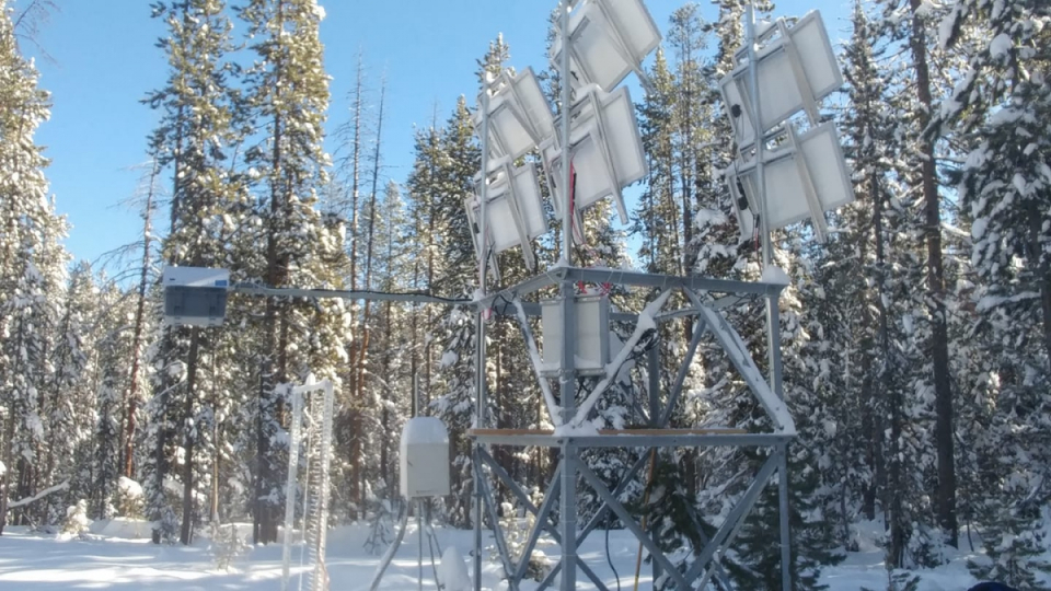
The total mass of snow that is stored in the world’s mountains is still unknown. Estimates from local measurements are unrealistic where they are sparse, weather models poorly estimate snowfall, and current remote sensing observations have inherent limitations. Yet, accurate snow mass estimates are critically needed to provide information on the associated water resources. More than a billion people rely on water from snow, most of which originates in the Northern Hemisphere mountain ranges. C-SNOW aims at mapping the snow mass in the Northern Hemisphere mountains based on satellite observations from the ESA and Copernicus Sentinel-1 mission. Sentinel-1 routinely offers high-resolution radar measurements at C-band (5.4 GHz). With an innovative algorithm, changes in these radar measurements over time can be translated into snow accumulation or depletion. Coincident with the Sentinel-1 algorithm development, field campaigns are organized in the Rocky Mountains (Idaho, USA). Several replicas of the Sentinel-1 radar sensor have been built and mounted on towers to survey snow sites. This allows us to unravel into detail the impacts of snow properties, and how they evolve over time, on radar measurements. These new insights are further exploited to improve the Sentinel-1 algorithm for estimating snow mass.
Project outcome
Scientific results
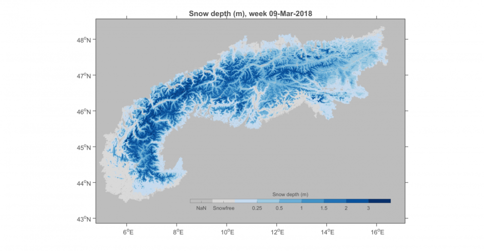
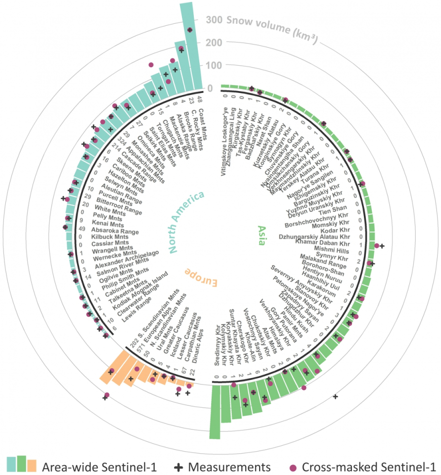
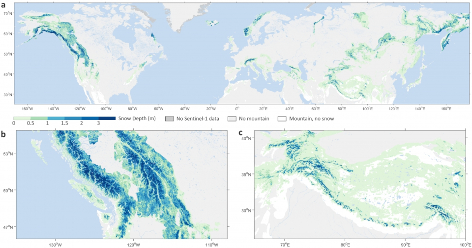
We developed a novel retrieval algorithm that allows to map the snow depth in mountain ranges at high spatial resolution based on ESA and Copernicus Sentinel-1 satellite observations. As a result, C-SNOW has provided novel insights into the spatio-temporal distribution of snow in mountain ranges across the Northern Hemisphere. The Sentinel-1 observations have been compared with ground measurements, land surface and snow model simulations and airborne lidar observations, showing good accuracy in the case of dry snow.
The project has revealed that Sentinel-1 radar backscatter observations often show a stronger sensitivity to (dry) snow accumulation than previously reported by the snow community. Tower-mounted radar measurements developed in the frame of the C-SNOW project have provided novel insights on scattering mechanisms in snow at C-band. Besides the typically strong scattering from the ground surface below the snowpack, also snow volume scattering and multiple scattering from snow layer interfaces, ice layers and refrozen percolation features after melt-refreeze cycles were found to contribute to the backscatter signal. Snow-ground scattering interactions can cause a delayed return to the sensor. These novel insights can support future retrieval algorithm and radiative transfer model development.
Societal (including environmental) relevance
The project has led to the development of an innovative technique to map snow depth in mountain ranges from satellite observations. Before, satellite-based snow depth observations were lacking in complex topography. The methodological developments and novel data can potentially benefit a wide range of scientific studies in cross-disciplinary fields (e.g., in hydrology, cryosphere, water-energy-carbon cycle interactions, wildlife migration, etc.) and operational applications (e.g., water management, flood and avalanche prediction, hydropower generation, and numerical weather prediction).
Products and services
A new dataset: Sentinel-1 snow depth observations (available through the project website: https://ees.kuleuven.be/project/c-snow). The data consist of observations over all the Northern Hemisphere mountains at 1 km spatial and less than weekly temporal resolution, and improved observations at 500 m resolution over the European Alps. Software: Sentinel-1 snow depth assimilation into the NASA LIS framework, distributed via GitHub (https://github.com/KUL-RSDA/LISF).
Potential users
Space agencies (ESA, NASA), meteorological offices and numerical weather prediction centers (ECMWF, Meteo-France), hydropower companies, water managers, avalanche control centers, tourism, agriculture, industry, the snow science community.
Outreach
STEREO researcher goes on snow expedition along with NASA
Un chercheur STEREO part en expédition avec la NASA
STEREO-onderzoeker vertrekt samen met NASA op sneeuwexpeditie
C-SNOW live from the Rockies via Instagram
C-SNOW en direct des Rocheuses avec Instagram
C-SNOW live vanuit de Rockies via Instagram
STEREO researchers publish a method for measuring snow depth by satellite in Nature Communications
| Project leader(s): | KULeuven - Division of Soil and Water Management | |
| Location: |
Global Region:
|
|
| Related presentations: | ||
| Website: | https://ees.kuleuven.be/project/c-snow/ | |