Publié le 18 août 2017
A peat wildfire was first detected in western Greenland on July 31st, and has since been captured by MODIS, Landsat and Sentinel-2 sensors. At this moment the wildfire is still growing and has an extent of several kilometers.
Progressing wildfires in July - August 2017
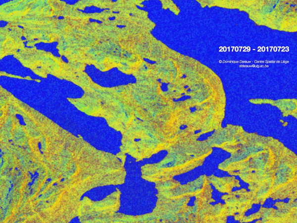
Fire extent is also monitored using Sentinel-1A and Sentinel-1B images. All available images are used - from a few days before the start of the fires until now - and interferometric coherence of each available 6-Days InSAR pair is computed. These coherence images shows essentially the soil stability between the two observation dates. If an area burns between the two acquisitions, coherence is lost. While an already burnt area will reappear as stable again and show a high coherence.
Each of these 6-Days coherence layers are assembled in an animation showing the fire propagation and extent.
All the processing, from data reading to geo-projection was performed using the CSL InSAR Suite fully developed through a series of successive Belspo/STEREO-financed projects, the most recent of which are: