Publié le 23 juin 2023
Research completed on the ship covers a wide range of areas, including atmospheric science, sea ice physics, ocean processes and ecosystem abundance.
Key Polarstern campaigns include the recent MOSAiC expedition, which was the most extensive research mission of its kind ever completed.
Thomas Krumpen, sea ice physicist and remote sensing expert at the Alfred Wegener Institute, said, “A key objective of Polarstern campaigns is to reduce the ship’s carbon emissions by planning more efficient routes across the seas – and the provision of timely radar data, such as those delivered by Copernicus Sentinel-1, has great potential to achieve this aim.”
The Sentinel-1 satellites of the EU’s Copernicus Earth Observation Programme host a C-band synthetic aperture radar (SAR) instrument that continues to gather observations during the day and night, and under all weather conditions.
The mission’s data are well suited for generating high-resolution maps of sea ice conditions in the Antarctic and Artic.
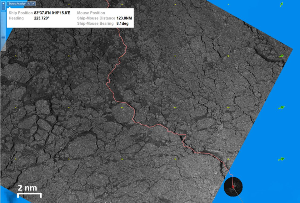
Polarstern charting system
This information can enable the planning of shorter and more efficient routes between different locations, reducing fuel burn and allowing more time for researchers to focus on their scientific objectives.
In addition, Sentinel-1 can help to target suitable areas for investigations; for example, researchers can use data from the mission to characterise a certain area of sea ice to ensure that it is representative of the surrounding region.
Krumpen added, “A crucial aim of the project is to ensure that these data are understandable and accessible to Polarstern’s commanding officers – and to achieve this, we use the vessel’s dedicated data visualisation system.”
As well as data from Sentinel-1, this system draws on observations from commercial remote sensing missions and many other in-situ and airborne data sources, to provide a comprehensive overview of the various factors that influence route-planning decisions.
Felix Lauber, navigating officer onboard Polarstern, said, “Not long ago, officers on Polarstern’s bridge relied on rough, imprecise estimates of ice coverage, which often led to longer journey times, increased fuel burn – and even ships becoming beset in ice. Our first expedition with SAR images proved to be a turning point, enabling us to avoid adverse conditions and carryout expeditions more efficiently.
“Nowadays, as the number of ships operating in polar waters rapidly increases, the development of SAR satellite systems and products for ship operators are seen as mandatory to ensure the safe operation of vessels and to reduce impact on the environment.”
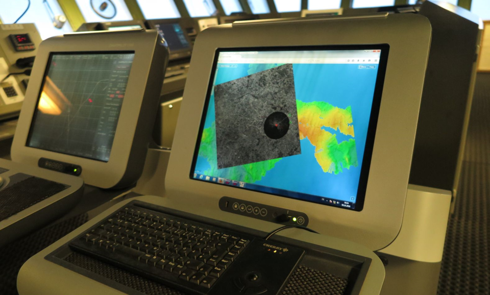
Navigating from Polarstern’s bridge
To ensure the timely delivery of data to Polarstern, the Alfred Wegener Institute procured the services of Drift+Noise, a remote sensing specialist that was previously supported by ESA’s Business Incubation Centre.
As well as providing data delivery services, Drift+Noise has developed its own navigation application, which is implemented on research, tourism, cargo and fishing vessels that do not have their own dedicated data visualisation systems.
Jakob Buenger, sea ice physicist and remote sensing expert at Drift+Noise, said, “Downloading and inspecting satellite data while on an expedition can be a long and complicated process, so we developed the map-based navigation tool called IcySea, which combines timely observations from Sentinel-1 with information from other remote sensing data layers.
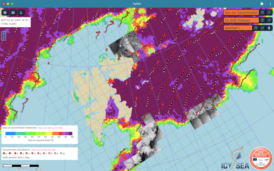
The IcySea app
“This tool has applications beyond polar expeditions, and could help to improve the efficiency of all shipping operations in ice-infested waters.”
About the Copernicus Sentinels
The Copernicus Sentinels are a fleet of dedicated EU-owned satellites, designed to deliver the wealth of data and imagery that are central to the European Union's Copernicus environmental programme. The European Commission leads and coordinates this programme, to improve the management of the environment, safeguarding lives every day.
ESA is in charge of the space component, responsible for developing the family of Copernicus Sentinel satellites on behalf of the European Union and ensuring the flow of data for the Copernicus services, while the operations of the Copernicus Sentinels have been entrusted to ESA and EUMETSAT.
Did you know that?
Earth observation data from the Copernicus Sentinel satellites are fed into the Copernicus Services. First launched in 2012, with the Land Monitoring and Emergency Management services, these services provide free and open support, in six different thematic areas.
The Copernicus Marine Environment Monitoring Service (CMEMS) provides regular and systematic reference information on the physical and biogeochemical state, variability and dynamics of the ocean and marine ecosystems for the global ocean and the European regional seas.
The Copernicus Climate Change Service (C3S) supports society by providing authoritative information about the past, present and future climate in Europe and the rest of the World.
Source:
European Space Agency. (2023, June 22). How satellite data enable greener polar exploration. Sentinel Success Stories - Sentinel Online.