Gepubliceerd op 22 juni 2021
Sentinel-6 is one of the European Union’s family of Copernicus missions but its implementation is the result of an exceptional cooperation between the European Commission, ESA, EUMETSAT, NASA and NOAA, with contribution from the CNES French space agency. The mission comprises two identical satellites launched five years apart: Copernicus Sentinel-6 Michael Freilich launched on 21 November 2020 and Copernicus Sentinel-6B, which will be launched in 2025.
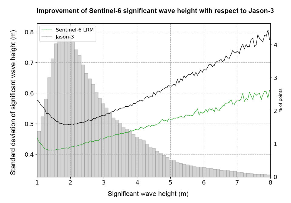
Sea-level rise is a key indicator of climate change so accurately monitoring the changing height of the sea surface over decades is essential for climate science, for policy-making and, ultimately, for protecting the lives of those in low-lying regions at risk.
Using the latest radar altimetry technology, developed by ESA, this new mission will advance the long-term record of sea-surface height measurements that began in 1992 by the French–US Topex-Poseidon satellite and then the Jason series of satellite missions.
Sentinel-6 Michael Freilich will soon pick up the baton and extend this dataset – a dataset that is the ‘gold standard’ for climate studies.
Julia Figa Saldana, ocean altimetry programme manager at Eumetsat, said, “We have been flying Copernicus Sentinel-6 Michael Freilich on the same orbit as the current altimetry reference mission, Jason-3, for the past six months so that the satellites have the same ‘view’ of the ocean.