Gepubliceerd op 7 juli 2022
The analysis – led by scientists from the Universitat Politècnica de València – drew on data from the WorldView-3 satellite, which were delivered on a free basis via ESA’s Third Party Missions (TPM) programme. It also used imagery collected by the US-led Landsat 8 mission. Methane is less abundant in the atmosphere than carbon dioxide, but it is a more powerful heat-trapping gas. As a result, scientists believe that addressing methane leaks from human activities could be key for the global drive to tackle climate change. Using satellites to monitor methane emissions from offshore oil and gas infrastructure could make important contributions to these mitigation efforts.
However, despite the rapid development of space-based methane plume detection methods over land, it remains difficult to use remote sensing missions to monitor these emissions over sea. Methane detection from space involves the use of shortwave infrared wavelengths. But the high absorption of this radiation by water limits the amount of light bouncing back to the satellite’s sensor, making it problematic to distinguish methane emissions.
As part of the analysis, the researchers overcame this challenge by using an imaging mode in which the angular configuration of the satellite is adjusted.
The study focused on oil and gas production activities off the coast of the Mexican state of Campeche, in one of the country’s major oil fields. The initial aim of the analysis was to explore the feasibility of using WorldView-3 to monitor offshore methane plumes.
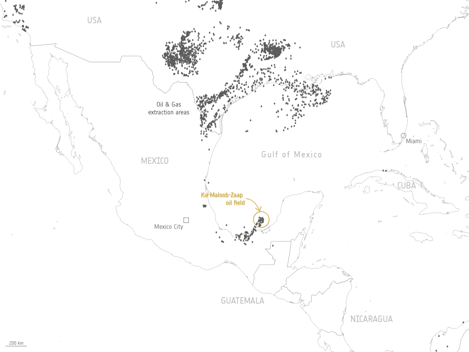
Oil and gas extraction areas
Launched in 2014, WorldView-3 is a multispectral Earth observing satellite that is owned and operated by US space technology firm Maxar. ESA added the mission to its TPM programme in 2016. The satellite’s instrument – called the WorldView-110 camera – captures images in a number of spectral ranges, including eight bands of the short-wave infrared range. These data have a high resolution of 3.7 m and a high signal-to-noise ratio, which make it a powerful mission for methane mapping.
WorldView-3 and Landsat 8 enabled the researchers to detect large plumes emanating from within the study area.
The researchers identified a platform known as Zaap-C as being responsible for the plumes, which were emitted from two boom-type flares linked to oil and gas production and separation.